
Recent datasets
This project focuses on understanding the current and future risks and responses of invasive species in the Wet Tropics. The aim is to develop a strategic approach to pest management that considers the complexity of ecological processes involved with establishment and spread and takes account of the values and assets in the region. The project will contribute to the management of invasive plants and animals by providing prioritisation tools that align with existing regional pest management frameworks.
Little is known about the impacts of fire on rainforest vegetation or the animals which depend on it. This project will investigate the positive and negative impacts of fire on rainforest vegetation and wildlife. In collaboration with NPRSR rangers, and where possible with local NGOs and Indigenous Rangers, we propose to establish vegetation and faunal monitoring sites across the rainforest/woodland boundaries and associated vegetation types in key areas of the Mission Beach, Tully lowlands and Hinchinbrook Channel areas to assess faunal and floral status and trends.
This project involved an assessment of all existing and potential sources of pollution to the Torres Strait marine environment. This was combined with information on water movement patterns to assess the hazard (and to some degree risk) of these pollutant sources to marine ecosystems and public health. This project was predominantly a desktop study with some field work to sewage treatment plants, and other point sources of potential pollutants.
This project undertook a scoping study to develop a robust approach that will allow us in Phase 2 to carry out an ecological risk assessment (ERA) of nutrients, fine suspended sediments, and pesticides used in agriculture in the GBR region including ranking the relative risk of individual contaminants originating from priority catchments to the GBR ecosystems using a systematic, objective and transparent approach.
This project will implement monitoring programs for the endangered southern cassowary, Casuarisus casuarius, and the vulnerable spectacled flying-fox, Pteropus conspicillatus.
Cassowary monitoring will be based on regular surveys to collect dung. DNA fingerprinting of the bird dung will provide data on cassowary abundance and distribution, the influence of habitat type and the structure and phylogeography of cassowary populations across the region.
This project is conducting surveys of frogs and other vertebrates in ecotonal areas of the Wet Tropics and Eungella.
This project will map the genetic and phylogenetic diversity of northeast Queensland rainforest plants and fungi with a focus on the mountaintop species, which are regarded as among the most at risk from climate warming. The project consists of two nested subprojects.
This project will act as an integrating focus within the rainforest theme to strategically target research gaps and thereby increase our understanding of the drivers of rainforest biodiversity. We will generate high resolution maps and landscape scale estimates of temporal trends in the condition of biodiversity and environmental changes.
The project consists of four subprojects:
A. Monitoring: Tasks include a microsensor network, standardised vertebrate surveys, habitat structure monitoring and data harvesting from other projects.
This project will examine the status, diversity and condition of mangroves and freshwater habitats in the Torres Strait. This will provide a baseline against which future changes can be assessed and will also enable planning for adaptation to potential sea level rise/increased storm surge. The project builds on Torres Strait Islanders’ knowledge and understanding of mangrove habitats, with scientists working in partnership with Traditional Owners.
This project will:
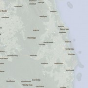
This dataset contains point features depicting mountains, peaks, mountain ranges and hills and their names. Ranges are located with a point or series of points in the approximate vicinity of the feature.
Mountain data originated from 1:250,000 scale AUSLIG supplied topographic data (repromats). Corrections were made to locate the points accurately to the 1:100,000 scale National Topographic Map Series. Georeferenced Topographic Maps are dated 1966.
This dataset consists of a 90 KB point shapefile containing 344 features.
This dataset is a complete state-wide digital land use map of Queensland. The dataset is a product of the Queensland Land Use Mapping Program (QLUMP) and was produced by the Queensland Government. It presents the most current mapping of land use features for Queensland, including the land use mapping products from 1999, 2006 and 2009, in a single feature layer. This dataset was last updated July 2012. The dataset comprises an ESRI vector geodatabase at a nominal scale of 1:50,000 in coastal regions and 1:100 000 in Western Queensland.
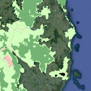
This dataset contains polygon features that represent the zoning classification of lands within the Wet Tropics World Heritage Area. This dataset is a working depiction only.
For legal confirmation, refer to signed maps held at WTMA. The official zoning maps for the Wet Tropics of Queensland World Heritage Area can be downloaded from http://www.wettropics.gov.au/zoning-maps
The Collaborative Australian Protected Areas Database (CAPAD) 2010 provides both spatial and text information about government, Indigenous and privately protected areas for continental Australia. State and Territory conservation agencies supplied data current for various dates between June 2010 and January 2011. This is the eighth version of the database, with previous versions released in 1997, 1999, 2000, 2002, 2004, 2006 and 2008. CAPAD provides a snapshot of protected areas that meet the IUCN definition of a protected area:
This project focuses on improving methods to detect the introduction of exotic animal diseases into the Torres Strait. The researchers will examine the environmental factors that influence the establishment and persistence of wildlife diseases in the region. They will study insect disease vectors and the incidence of disease in birds in a range of habitats in order to identify where disease risk is greatest. Field studies will be conducted using replicated mosquito trapping and mist netting of birds in Torres Strait, at sites identified from previous projects.
Outcomes include:
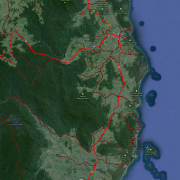
This dataset contains line features depicting road classification within the Wet Tropics World Heritage Area. There are five categories of roads in the Wet Tropics World Heritage Area roads where motor vehicle use is allowed by the public. These are as follows:
1. State-controlled road: roads which form part of the State’s road network.
2. Community access road: significant roads for local community transport.
3. Presentation road: roads which provide opportunities for presentation of the WHA
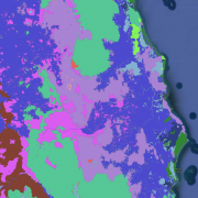
This dataset contains polygons depicting geology as deliniated by botanist J.P.Stanton and geologist D.J.Stanton within the Wet Tropics bioregion.
The geology mapping of the Wet Tropics Bioregion is based on interpretation of aerial photographs during WTMAs Vegetation of the Wet Tropics of Queensland bioregion mapping project. Aerial photography was also used to select sites and traverses for ground truthing work. The geological classification and boundaries were based on their relevence to vegetation patterns.
Surveys were carried out in targeted shallow seabed environments within the proposed Oceanic Shoals Commonwealth Marine Reserve (CMR) in the Timor Sea. The survey concentrated on shelf habitats (< 200m) of the western part of the Oceanic Shoals CMR and included potential biodiversity hotspots such as pinnacles, banks and shoals.
Towed video (Towvid) surveys were undertaken in February/March 2007 and August/September 2007 on two pairs of discrete deepwater shoals in the mid-shelf section of the southern Great Barrier Reef. Within each pair, one shoal was from a 'green zone' (closed to all fishing) and the other from a 'blue zone' (open to fishing), based on the rezoning of the Great Barrier Reef Marine Park, carried out in 2004. The pairs of reefs chosen were: East Warregos (green) and West Warregos (blue); Barcoo Bank (green) and Karamea Bank (blue).
Surveys of green (no-take) zoned sites and blue (open to fishing) sites in adjacent areas of the northern Great Barrier Reef Marine Park were carried out to determine any effects which might be attributable to a change in zoning plan in 2004. Assessment of the fish communities was enumerated using baited underwater video sets (BRUVS) and towed video. \n \n'Cardwell shoals' comprised Brook Shoal (MNP-18-1077) as the site in the green zone; and Eva Rock and Forty Foot Rock as sites in in the "blue" zone in July, September and December 2006, November 2007 and May 2010.
Surveys were undertaken in January/February 2009 (summer) at the Capricorn-Bunker, Pompey and Swains Groups on deepwater reef bases (shoals) in the Great Barrier Reef. In each survey, reefs were paired with one zoned 'green' (closed to fishing) and the other 'blue' (open to all fishing) - 16 pairs of reefs. The demersal habitats and vertebrate communities were sampled using non-extractive baited remote underwater video stations (BRUVS), which revealed a diverse (c360 species) fauna of fish, sharks, rays and sea snakes.