 eAtlas Data Catalogue
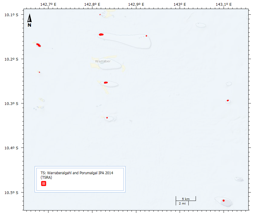
Warraberalgahl and Porumalgal Indigenous Protected Area (IPA) 2014 (TSRA)
This dataset shows the location and size of the 9 islands, cays and rocks that make up the Warraberalgahl and Porumalgal Indigenous Protected Area (IPA). The IPA is recognised as part of the National Reserve System and was officially declared on the 18/07/2014.
The declared area covers approximately 63 hectares. The following Islands, Cays and Rocks make up the IPA: Atub, Bara, Bini, Babui, Guiya, Maza Guiya, Miggi Maituin, Ugain and Ulu.
GPS coordinates were used to identify the islands using Google Earth and polygons were manually drawn over this imagery to create the dataset.
Simple
Identification info
- Date (Publication)
- 2014-07-18
Point of contact
Stewart, MelanieTorres Strait Regional Authority (TSRA)
Level 4, 38 Sheridan St
Cairns
Queensland
4870
Australia
- Topic category
-
- Boundaries
Extent
Extent
- Description
- Torres Strait
N
S
E
W
))
- Keywords (Theme)
-
- marine
Resource constraints
- Linkage
-
http://i.creativecommons.org/l/by/3.0/au/88x31.png
License Graphic
- Title
- Creative Commons Attribution 3.0 Australia License
- Website
-
http://creativecommons.org/licenses/by/3.0/au/
License Text
- Language
- English
- Character encoding
- UTF8
Distribution Information
- OnLine resource
- Indigenous Protected Areas, Department of the Environment
- OnLine resource
- eAtlas Web Mapping Service (WMS) (AIMS)
- OnLine resource
- Warraberalgahl and Porumalgal IPA V1 Shapefile. [Zip 103 kB]
- OnLine resource
- tsra:TS_TSRA_Warraberalgahl-Porumalgal-IPA_2014
Resource lineage
- Hierarchy level
- Dataset
Metadata
- Metadata identifier
- urn:uuid/81e94984-4d5b-44d5-8fd3-e448ace331eb
- Language
- English
- Character encoding
- UTF8
Point of contact
Stewart, MelanieTorres Strait Regional Authority (TSRA)
Level 4, 38 Sheridan St
Cairns
Queensland
4870
Australia
Type of resource
- Resource scope
- Dataset
- Metadata linkage
-
https://eatlas.org.au/data/uuid/81e94984-4d5b-44d5-8fd3-e448ace331eb
Point of truth URL of this metadata record
- Date info (Creation)
- 2015-12-10T08:26:31
- Date info (Revision)
- 2024-02-03T08:13:54
Metadata standard
- Title
- ISO 19115-3:2018
Overviews
large_thumbnail
Spatial extent
N
S
E
W
Provided by

Associated resources
Not available