 eAtlas Data Catalogue
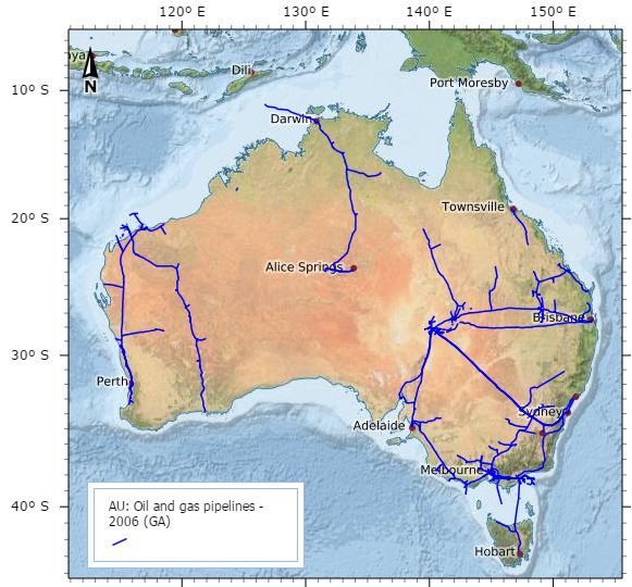
Oil and Gas Pipelines of Australia 2004 (GA)
This data set contains information on Oil and Gas pipeline infrastructure. This dataset has been converted from Microstation format used in a map "Petroleum Exploration and Development Titles" published annually in APRIL. Attributes have been added to comply with data standards and minor coding of line work has been achieved using annotation from the map. Further data has been added, specifically for the specific Acreage Release Areas.
This metadata was prepared for the North West Atlas and is not authoritative. Please contact the custodian for the latest authoritative version of this record.
Simple
Identification info
- Date (Publication)
- 2004-01-01T00:00:00
- Citation identifier
- 66016
- Citation identifier
- http://www.ga.gov.au/metadata-gateway/metadata/record/66016/
Spatial resolution
Equivalent scale
- Denominator
- 5000000
- Topic category
-
- Geoscientific information
Extent
Extent
N
S
E
W
))
- Maintenance and update frequency
- As needed
- Keywords
-
- Petroleum Data
- Wells
- Keywords (Theme)
-
- natural gas
- marine
- hydrocarbons
- dataset
- National dataset
- Australian and New Zealand Standard Research Classification (ANZSRC)
-
- Petroleum and Coal Geology
Resource constraints
- Access constraints
- Other restrictions
- Other constraints
- license
Resource constraints
- Use constraints
- License
- Use constraints
- Other restrictions
- Other constraints
- Creative Commons Attribution 4.0 International Licence
Resource constraints
- Classification
- Unclassified
- Language
- English
- Character encoding
- UTF8
Distribution Information
- Distribution format
-
- shp
Distributor
- Medium note
- onLine
- OnLine resource
- ga:AU_GA_Oil-gas-pipelines_2006
- OnLine resource
- Shapefile [Zip 870 kB]
- OnLine resource
- Oil and Gas Pipelines of Australia (Geoscience Australia)
Resource lineage
- Statement
- This dataset has been converted from Microstation format used in a map "Petroleum Exploration and Development Titles" published annually in APRIL. Attributes have been added to comply with data standards and minor coding of line work has been achieved using annotation from the map. Further data has been added, specifically for the specific Acreage Release Areas.
- Hierarchy level
- Dataset
Metadata constraints
- Classification
- Unclassified
Metadata
- Metadata identifier
- urn:uuid/9793add6-c663-4bff-a2af-4f0d0f2a062b
- Language
- English
- Character encoding
- UTF8
Type of resource
- Resource scope
- Dataset
- Name
- dataset - Petroleum Data - Wells
- Metadata linkage
- https://eatlas.org.au/data/uuid/9793add6-c663-4bff-a2af-4f0d0f2a062b
- Date info (Revision)
- 2023-09-18T08:19:04
- Date info (Creation)
- 2015-03-23T00:00:00
Metadata standard
- Title
- ISO 19115-3:2018
Overviews
large_thumbnail
Spatial extent
N
S
E
W
Provided by

Associated resources
Not available