 eAtlas Data Catalogue
1982
Type of resources
Topics
Contact for the resource
Provided by
Years
Representation types
status
-
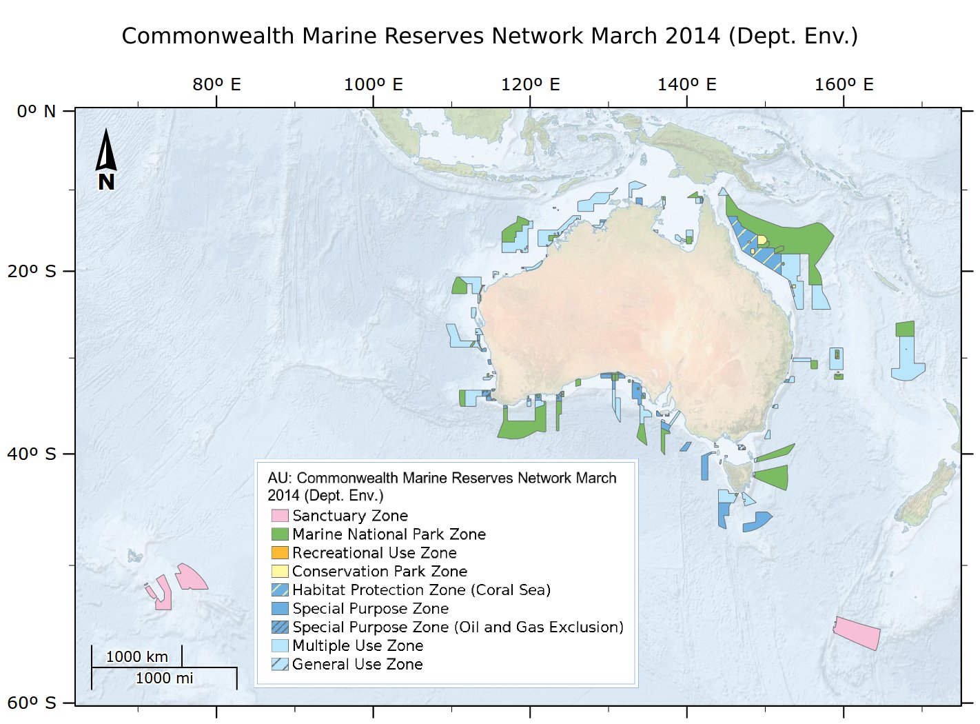
This dataset is not the current marine park zoning. It is retained here for historic purposes. See http://www.environment.gov.au/fed/catalog/search/resource/details.page?uuid=%7BCD8877F3-8C39-4A20-A53F-070FBEE5AF3C%7D for current zoning. Consistent with the Australian Government's commitment to develop a National Representative System of Marine Protected Areas (MPAs), networks of Commonwealth Marine Reserves have been proclaimed for Commonwealth waters across the South-west, North-west, North, Coral Sea and Temperate East Marine Regions. These networks build on previous Marine Protected Area proclamations, including the South-east network declared in 2007. This dataset is released under Creative Commons by Attribution-NonCommercial 3.0 Australia (CC BY-NC 3.0). IMPORTANT INFORMATION FOR MARINE USERS Transitional arrangements apply to the South-west, North-west, North and Temperate East Networks and the Coral Sea reserve, until management plans come into effect. These arrangements involve NO CHANGES ON THE WATER for marine users. Note, there are no changes to management arrangements in the marine reserves that existed prior to the establishment of the new reserves, that is, the same restrictions on activities will continue to apply even where those reserves have been incorporated into new reserves. The South-east Network of Commonwealth Marine Reserves is managed under the South-east Commonwealth Marine Reserves Network Management Plan 2013-23, in place from 1 July 2013. More information is available at www.environment.gov.au/marinereserves This data contains spatial and contextual information about Commonwealth Marine Reserves under the jurisdiction of the Commonwealth governments Environment Protection and Biodiversity Conservation Act 1999, which are managed by the Australian Government Department of the Environment. It does not include data on MPA's in other Australian jurisdictions (e.g. the Great Barrier Reef Marine Park, State/Territory parks), or Terrestrial Protected Areas with marine components (eg Pulu Keeling National Park). This is an extract of the full metadata record supplied by the Department of the Environment with this dataset. See http://www.environment.gov.au/fed/catalog/search/resource/details.page?uuid=%7B0435E716-1798-467C-8F43-E0CB6B32E8EF%7D for more information. eAtlas Change Log: 2023-04-04 - Marked the metadata as superseded. Fixed the link to the official data download. Updated the modification date. Changed the copyright from '© Commonwealth of Australia, Australian Government Department of the Environment, 2014' to the current '© Commonwealth of Australia, Australian Government Department of Climate Change, Energy, the Environment and Water, 2014'. Copied over additional lineage. Corrected the licensing from CC BY-NC 2.5 to CC BY-NC 3.0 eAtlas notes: This dataset is cached in the eAtlas enduring data repository at: data\non-custodian\pre-2015\AU_DotE_Comm-marine-reserves-2014