 eAtlas Data Catalogue
GeoTiff
Type of resources
Topics
Keywords
Contact for the resource
Provided by
Years
Formats
Representation types
status
-
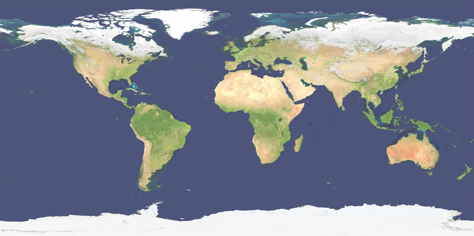
This layer shows a 500m resolution image of the world derived from the Blue Marble Next Generation April 2004 image (86400x43200 pixels). As the image was derived from MODIS satellite imagery during Autumn in the Northern Hemisphere the high latitude countries (Russia, Canada, etc) are covered in snow. The colour and tonal range of the original Blue Marble image was compressed and brightened to make the image suitable for use as a basemap. In addition to this noise filtering was applied to de-clutter the image somewhat to make it more suitable as a layer under hillshading, with the aim of the layer being to provide colour to the hillshading. The processing of the images was performed in Photoshop and the geo-referencing and final preparation was done using GDAL. This image is made available as a 357 MB JPEG compressed GeoTiff file as part of the Bright Earth basemap dataset.