 eAtlas Data Catalogue
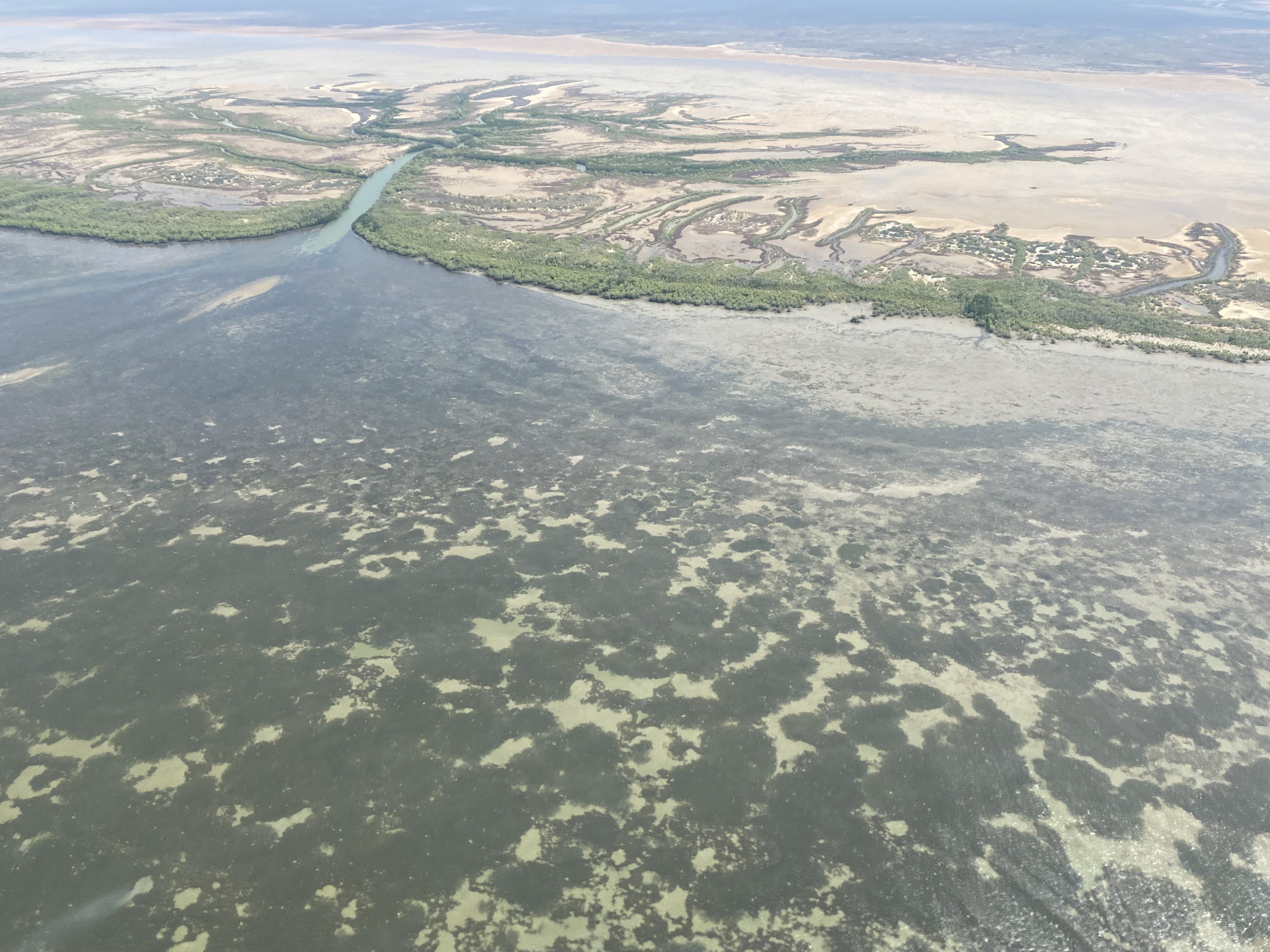
NESP MaC Project 1.12 – Mapping critical habitat in Yanyuwa Sea Country 2021-2022 (CDU)
This record provides an overview of the NESP Marine and Coastal Hub small-scale study - "Mapping critical habitat in Yanyuwa Sea Country". For specific data outputs from this project, please see child records associated with this metadata.
Marra and li-Anthawirriyarra rangers seek to build on existing partnerships with CDU and JCU to map the intertidal habitats of the Yanyuwa Indigenous Protected Area (IPA) and coastal areas connected to it, an area of profound importance to these communities and the marine ecosystem of the Gulf of Carpentaria (GoC). Significant co-funding will be provided by the Mabunji Aboriginal Corporation (MAC) and DAWE Migratory Species Section to conduct a large-scale mapping project that will inform Marra and Yanyuwa community decisions that underpin sustainable management and facilitate continued connection with sea country. Co-funding from NESP2 is sought to provide salary for data processing and reporting for these surveys. This project also leverages existing funding allocated to training, capacity building, community consultation and communication products committed to by the rangers, CDU, JCU, the Australian and the NT Governments.
Planned Outputs
• Benthic survey data and habitat maps [spatial dataset]
• Final technical report with analysed data and a short summary of recommendations for policy makers of key findings [written]
Simple
Identification info
- Date (Creation)
- 2022-05-27T00:00:00
- Credit
- Team members: Rachel Groom (Charles Darwin University), Alex Carter (James Cook University (JCU)), Catherine Collier (JCU), Lloyd Shepherd (JCU), Shaun Evans (Mabunji Aboriginal Corporation (MAC)), David Barret (MAC), Stephen Barret (MAC)
- Credit
- National Environmental Science Program (NESP) Marine and Coastal Hub
- Credit
- Department of Agriculture, Water and the Environment (DAWE), Australian Government
- Credit
- In addition to NESP (DAWE) funding, this project is matched by an equivalent amount of in-kind support and co-investment from project partners and collaborators.
- Topic category
-
- Biota
Extent
Extent
- Description
- Project extent
Temporal extent
- Time period
- 2021-09-01 2022-09-01
Extent
Extent
- Description
- Marine and coastal region of Australia

- Keywords (dataSource)
-
- National Environmental Science Program (NESP) Marine and Coastal Hub
- Keywords (Theme)
-
- marine
- AODN Geographic Extents Vocabulary
-
- Coastal Waters (Australia)
Resource constraints
- Classification
- Unclassified
Resource constraints
- Use limitation
- The data collections described in this record are funded by the Australian Government Department of Agriculture, Water and the Environment (DAWE) through the NESP Marine and Coastal Hub.
Resource constraints
- Linkage
-
http://i.creativecommons.org/l/by/4.0/88x31.png
License Graphic
- Title
- Creative Commons Attribution 4.0 International License
- Website
-
http://creativecommons.org/licenses/by/4.0/
License Text
- Language
- English
- Character encoding
- UTF8
Distribution Information
- OnLine resource
- Project page on NESP Marine and Coastal Hub website
- OnLine resource
- NESP Marine and Coastal Hub website
- OnLine resource
- NESP MaC - Round 1 page
Metadata
- Metadata identifier
- urn:uuid/0eb63db1-bf27-4107-ac0d-ba3c2c5b0821
- Language
- English
- Character encoding
- UTF8
Point of contact
eAtlas Data ManagerAustralian Institute of Marine Science (AIMS)
- Parent metadata
Type of resource
- Resource scope
- Field session
- Name
- NESP MaC hub Project 1.12
- Metadata linkage
-
https://eatlas.org.au/data/uuid/0eb63db1-bf27-4107-ac0d-ba3c2c5b0821
Point of truth URL of this metadata record
- Date info (Creation)
- 2022-05-10T16:08:28
- Date info (Revision)
- 2024-02-03T12:26:53
Metadata standard
- Title
- ISO 19115-3:2018
Overviews


Spatial extent

Provided by
