 eAtlas Data Catalogue
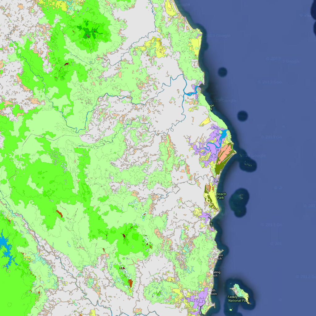
Vegetation mapping of the Wet Tropics Bioregion 2008 (WTMA)
This dataset contains polygons depicting vegetation communities of the Wet Tropics Bioregion. Over 250 vegetation types are described using structural and floristic characteristics, and the vegetation communities have been classified using a logical, hierarchical framework.
At a broad level, the vegetation includes the rainforests, forests and woodlands, sclerophyll rainforests, shrublands and heathlands, herblands and mangrove communities distributed throughout the bioregion.
The dataset is derived from 1:25 000 stereo aerial photography. J.P. Stanton and D.J. Stanton delineated vegetation and geology types by manually interpreting and drawing polygons directly onto the aerial photography.
The vegetation of the Wet Tropics Bioregion GIS dataset is also available to or those with ArcGIS capacity. Contact wettropics@wtma.qld.gov.au for more information. wettropics@wtma.qld The vegetation of the Wet Tropics Bioregion GIS dataset is also available to or those with ArcGIS capacity. Contact wettropics@wtma.qld.gov.au for more information.
Attributes
The vegetation has been classified into 5 levels, each of increasing level of detail. The following is the list of unique values for the first three levels. For the complete list of all 5 levels please refer to the 'Vegetation Levels 1 to 5 classification list' document.
Level_1:
* Vegetated,
* Unvegetated
Level_2:
* Sclerophyll forests and woodlands,
* Cleared, unvegetated or non-native
* Rainforests
* Mangroves
* Non-woody vegetation
* Shrublands and heathlands
* Vegetation complexes and mosaics
* Sclerophyll and sclerophyll rainforest transitions
Level_3:
* Eucalyptus forests and woodlands
* Melaleuca forests and woodlands
* Water bodies
* Mesophyll rainforests
* Mangrove forests
* Mangrove grasslands and herblands
* Rural, agricultural or urban areas
* Grasslands
* Shrublands and heathlands
* Coastal beach complexes
* Riparian complexes
* Naturally unvegetated
* Closed Acacia forests
* Closed Eucalyptus forests
* Acacia forests and woodlands
* Microphyll thickets
* Notophyll rainforests
* Secondary successional complexes
* Casuarina forests and woodlands
* Sedgelands
* Rock pavement and coastal headland complexes
* Lophostemon forests and woodlands
* Fern complexes
* Microphyll rainforests
* Palm-leaf rainforests
* Wetland complexes
* Syncarpia forests and woodlands
* Notophyll thickets
* Closed Lophostemon forests
Positional accuracy
The positional accuracy of the mapped vegetation polygons is ±12 metres from the true position as depicted on the Australian 1:50 000 Topographic Survey Map Series R733. Horizontal accuracy is estimated at 90% of well-defined detail within ±50 metres of true position.
Attribute accuracy
Attribute accuracy is estimated at 95%.
Citation
Wet Tropics Management Authority (2009). Vegetation Mapping of the Wet Tropics Bioregion of Queensland. Wet Tropics Management Authority, Cairns.
Acknowledgements
The expert assistance and advice of James Cook University and the Queensland Herbarium is gratefully acknowledged.
/Base data/Data reproduced with permission of Wet Tropics Management Authority/
This metadata was prepared for the eAtlas and is not authoritative. Please contact the Wet Tropics Management Authority for an authoritative record.
Simple
Identification info
- Date (Publication)
- 2013-12-01T10:43:00
- Status
- Completed
- Topic category
-
- Biota
Extent
Extent
))
Temporal extent
- Time position
- 2000-12-18
- Time position
- 2008-12-04
Resource constraints
- Use limitation
- Wet Tropics Management Authority
- Use constraints
- Copyright
Resource constraints
- Use limitation
- This dataset was made available to the eAtlas from WTMA under a restrictive non-commercial license. This license has restrictions to: a) not make the data available to a third party by sale or otherwise; and b) not sell products derived from the data; and c) not use the data to cause substantial distortion to normal competitive arrangements; and d) not use the data to derive income or gain a financial return. The full license is stored with the datasets. Base data/Data reproduced with permission of Wet Tropics Management Authority.
- Use constraints
- License
- Language
- English
- Character encoding
- UTF8
Distribution Information
- Distribution format
-
- ESRI Shapefile
- OnLine resource
- wtma:WT_WTMA_WTMaps-2008_Vegetation
- OnLine resource
- Interactive map of this dataset
- OnLine resource
- eAtlas Web Mapping Service (WMS) (AIMS)
- OnLine resource
- Vegetation Levels 1 to 5 classification list [Text file 46 kB]
- OnLine resource
- PDF Vegetation Maps (WTMA)
Metadata
- Metadata identifier
- urn:uuid/82f4c977-caf3-497c-92c8-d2db7a18be89
- Language
- English
- Character encoding
- UTF8
Point of contact
eAtlas Data ManagerAustralian Institute of Marine Science (AIMS)
Type of resource
- Resource scope
- Dataset
- Metadata linkage
-
https://eatlas.org.au/data/uuid/82f4c977-caf3-497c-92c8-d2db7a18be89
Point of truth URL of this metadata record
- Date info (Creation)
- 2015-02-18T15:13:59
- Date info (Revision)
- 2024-02-03T08:21:38
Metadata standard
- Title
- ISO 19115-3:2018
Overviews
Spatial extent
Provided by
