 eAtlas Data Catalogue
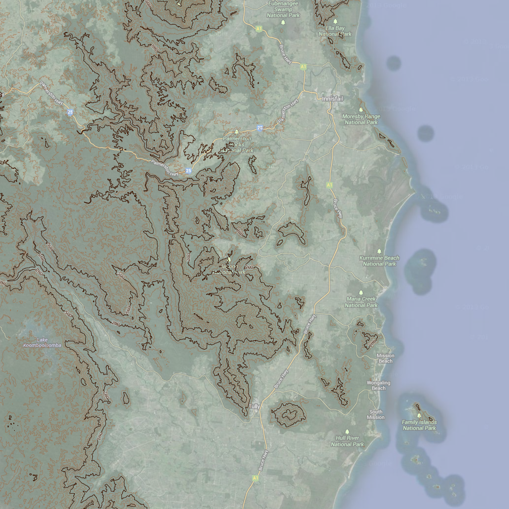
Wet Tropics Bioregion - Contours (WTMA)
This dataset contains line and point features depicting contours across the Wet Tropics Bioregion as shown on the 1:50,000 scale National Topographic Maps.
The dataset derives from Geoscience Australias 1:50,000 scale National Topographic Map Series data.
Accuracy: Horizontal accuracy is at 90% of well-defined detail within +/- 25m of true position.
Data reproduced with permission of Wet Tropics Management Authority.
This metadata was prepared for the eAtlas and is not authoritative. Please contact the Wet Tropics Management Authority for an authoritative record.
Simple
Identification info
- Date (Publication)
- 2013-12-01T10:43:00
- Status
- Completed
- Topic category
-
- Biota
Extent
Extent
N
S
E
W
))
Resource constraints
- Use limitation
- Wet Tropics Management Authority
- Use constraints
- Copyright
Resource constraints
- Use limitation
- This dataset was made available to the eAtlas from WTMA under a restrictive non-commercial license. This license has restrictions to: a) not make the data available to a third party by sale or otherwise; and b) not sell products derived from the data; and c) not use the data to cause substantial distortion to normal competitive arrangements; and d) not use the data to derive income or gain a financial return. The full license is stored with the datasets. Base data/Data reproduced with permission of Wet Tropics Management Authority.
- Use constraints
- License
Resource constraints
- Use limitation
- Full citation: Wet Tropics Management Authority (2013). Contours of the Wet Tropics Bioregion of Queensland. Wet Tropics Management Authority, Cairns.
- Language
- English
- Character encoding
- UTF8
Distribution Information
- Distribution format
-
- OnLine resource
- wtma:WT_WTMA_Contour_100m
- OnLine resource
- wtma:WT_WTMA_Contour_200m
- OnLine resource
- Interactive map of this dataset
- OnLine resource
- eAtlas Web Mapping Service (WMS) (AIMS)
Reference System Information
Identifier
- Codespace
- EPSG
Metadata
- Metadata identifier
- e0e41db0-2846-4afd-a244-8d286a84882b
- Language
- English
- Character encoding
- UTF8
Point of contact
Lawrey, Eric, Dr.Australian Institute of Marine Science (AIMS)
PRIVATE MAIL BAG 3, TOWNSVILLE MAIL CENTRE
Townsville
Queensland
4810
Australia
Type of resource
- Resource scope
- Dataset
- Metadata linkage
-
https://eatlas.org.au/data/uuid/e0e41db0-2846-4afd-a244-8d286a84882b
Point of truth URL of this metadata record
- Date info (Creation)
- 2018-08-20T02:05:31
- Date info (Revision)
- 2018-08-20T02:05:31
Metadata standard
- Title
- ISO 19115-3:2018
Overviews
large_thumbnail
Spatial extent
N
S
E
W
Provided by

Associated resources
Not available