 eAtlas Data Catalogue
50000
Type of resources
Topics
Contact for the resource
Provided by
Representation types
Update frequencies
status
Scale
-
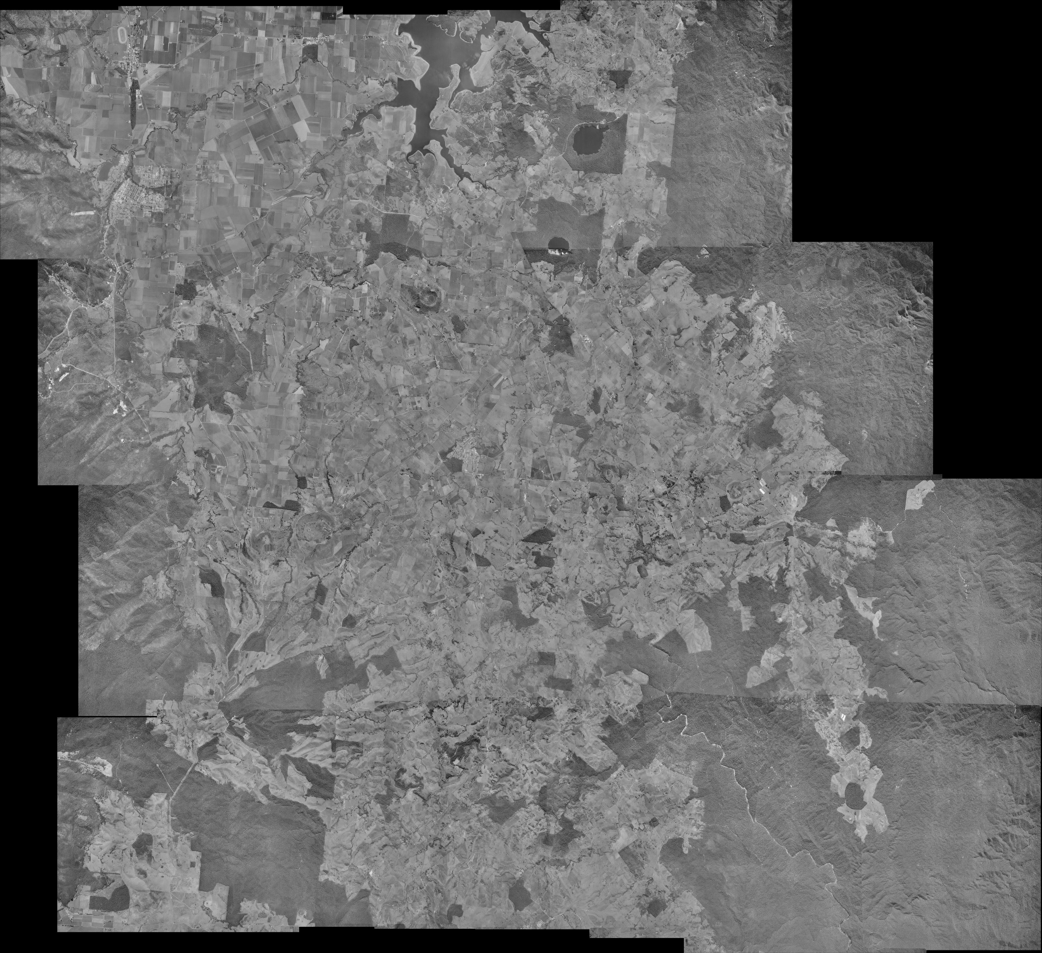
This dataset is a photo mosaic of historic aerial imagery of the southern Atherton Tablelands from 16th June 1978. It includes the towns of Atherton, Malanda, Yungaburra and Tolga. It has a southern boundary just north of Millaa Millaa, a northern boundary of Lake Tinaroo, an eastern boundary of a quarter of Wooroonooran National Park and a western boundary of Atherton. This photo mosaic was compiled to assist in the location of rainforest regrowth areas for the NERP-TE project 12.2, Harnessing natural regeneration for cost-effective rainforest restoration (Griffith University, University of Queensland). This photo mosaic was produced by Atherton Tablelands Geographical Information Services (ATGIS), April 2012, from digital data provided by Department of Environment and Resource Management (DERM), Queensland. Aerial photography ownership; Department of Environment and Resource Management (Queensland). Aerial photography data is "© State of Queensland (Department of Environment and Resource Management) [2012]". The photo mosaic is 13792x12623 pixels with a pixel size of 2.75mx2.75m and has a spatial reference of MGA55 (EPSG:28355). The original mosaic is stored in ECW format (18 MB). A GeoTiff version of the mosaic was created for the eAtlas (440 MB).