Using KML files in Google Earth
There are many location in the e-Atlas where you will find KML (Keyhole Markup Language) files. These will always in their zipped form known as KMZ. Make sure you have the most recent version of Google Earth otherwise KML files may not display correctly. The KMLs should display on most browsers and operating systems.
There are many sources of information on Google Earth and KMLs at https://www.google.com/earth/.
To load and display a KMZ in Google Earth simply double-click the file name in your file manger and open Google Earth and use the File Open (Ctrl-O). That will load and display the KMZ as a map.
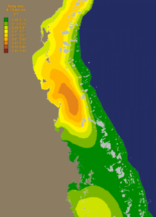
The most common form of the KMZs will contain two maps each with a legend, point data, an about text box and a background for the legends and logo (Figure 1). All elements are accessible to the user and can be switched off or on, moved, re-ordered and made more or less transparent using the menus of the basic version of Google Earth. To access the elements you need to have the side bar open (Ctrl-Alt-B).
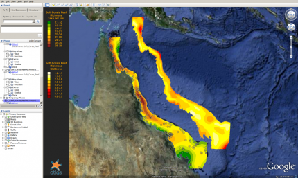
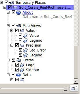
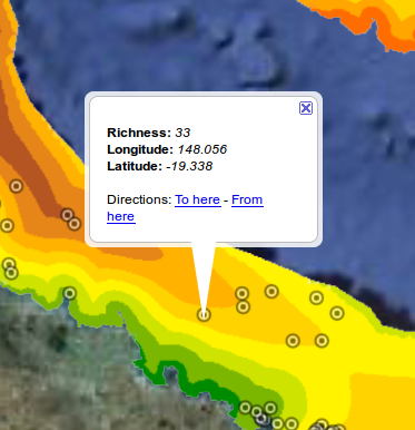
With the side bar open you should see the elements of the loaded KMZ in Places >> Temporary Places (Figure 2). The name of the file will be displayed and next to it will be an open-close box (- / +) that opens and closes the folders below the current one, and a check box (tick or blank) that switches layers off and on. Open up all the sub-folders of the loaded file and you will be able to access their elements. Experiment with switching layers off and on, and you can also rotate and change views by double clicking the names of the folders and sub-folders. The data points shown on the map can also be clicked to show the values and location of the point and the value can be compared to its estimated value in the contour map (Figure 3).
In addition to this standard two-map format there are other formats, but there is also a supplementary collection of KMLs that includes various coloured backgrounds, separate maps of the reefs and islands of the Great Barrier Reef and of the Queensland land, and the GBRMPA zoning and NRM regions. These maps are ordered to provided backgrounds and overlays that can enhance your displays of maps in Google Earth (Figure 4)