 eAtlas Data Catalogue
Contour
Type of resources
Topics
Keywords
Contact for the resource
Provided by
Representation types
status
Scale
-
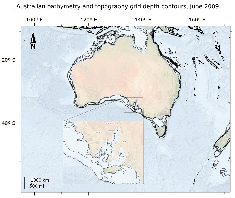
This dataset contains contours generated from the Australian bathymetry and topography grid, June 2009 version 4 by Geoscience Australia. It contains depth contours for -20m, -40m, -100m, -200m and -400m. Contours were generated in ArcMap using the Spatial Analyst Tools / Surface / Contour List tool. This output was then simplified using the Cartography Tools / Generalization / Smooth Line with a tolerance of 300m. The rest of this documentation is based on the metadata of the Australian bathymetry and topography grid itself. This grid is available from GA at http://dx.doi.org/10.4225/25/53D99B6581B9A . In 2005 Geoscience Australia and the National Oceans Office undertook a joint project to produce a consistent, high-quality 9 arc second (0.0025 deg or ~250m at the equator) bathymetric grid for Australian waters. In 2009 a number of new datasets were included in an updated version of the grid. The 2009 bathymetric grid of Australia has been produced to include recently acquired datasets, and solutions to issues identified in the previous version. The revised grid has the same extents as its 2005 counterpart, including the Australian water column jurisdiction lying between 92 deg E and 172 deg E, and 8 deg S and 60 deg S. The waters adjacent to the continent of Australia and Tasmania are included, as are areas surrounding Macquarie Island, and the Australian Territories of Norfolk Island, Christmas Island, and Cocos (Keeling) Islands. The area selected does not include Australia's marine jurisdiction offshore from the Territory of Heard and McDonald Islands and the Australian Antarctic Territory. This report details the datasets and procedures used to produce the 2009 bathymetric grid of Australia. As per the 2005 grid, the 0.0025 decimal degree (dd) resolution is only supported where direct bathymetric observations are sufficiently dense (e.g. where swath bathymetry data or digitised chart data exist) (Webster and Petkovic, 2005). In areas where no sounding data are available (in waters off the Australian shelf), the grid is based on the 2 arc minute ETOPO (Smith and Sandwell, 1997) and 1 arc minute ETOPO (Amante and Eakins, 2008) satellite derived bathymetry. The topographic data (on shore data) is based on the revised Australian 0.0025dd topography grid (Geoscience Australia, 2008), the 0.0025dd NZ topography grid (Geographx, 2008) and the 90m SRTM DEM (Jarvis et al, 2008). The final dataset has been provided in ESRI grid and ER Mapper (ers) formats. An associated shapefile has been produced so that the user can identify the input datasets that were used in the final grid. Data Location: This dataset is filed in the eAtlas enduring data repository at: data\other\AU_GA_Bathymetry-2009\derived\AU_e-Atlas-GA_Bathymetry-2009_Contours