Warraber Island - Torres Strait Temperature Logger (Flat Logger: WARRABERFL1)
Image
Licence

Description
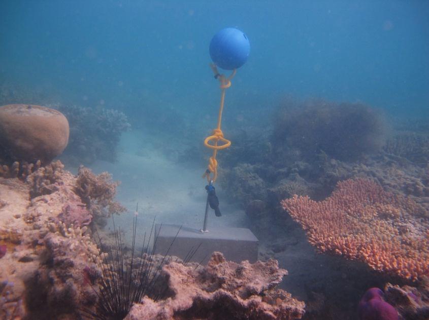
This photo shows the location of the temperature logger at Warraber Island started on 06/10/2012.
GPS position: 10°12.051S 142°49.147’E on WGS84 datum Depth: 2.1 m at mean tide 0.2 m at datum (Poll Is) Logger located on a concrete block in a sandy gully on the reef flat next to a plating Acropora.