Dugong Island - Torres Strait Temperature Logger (Slope Logger: DUGONGSL1)
Image
Licence

Description
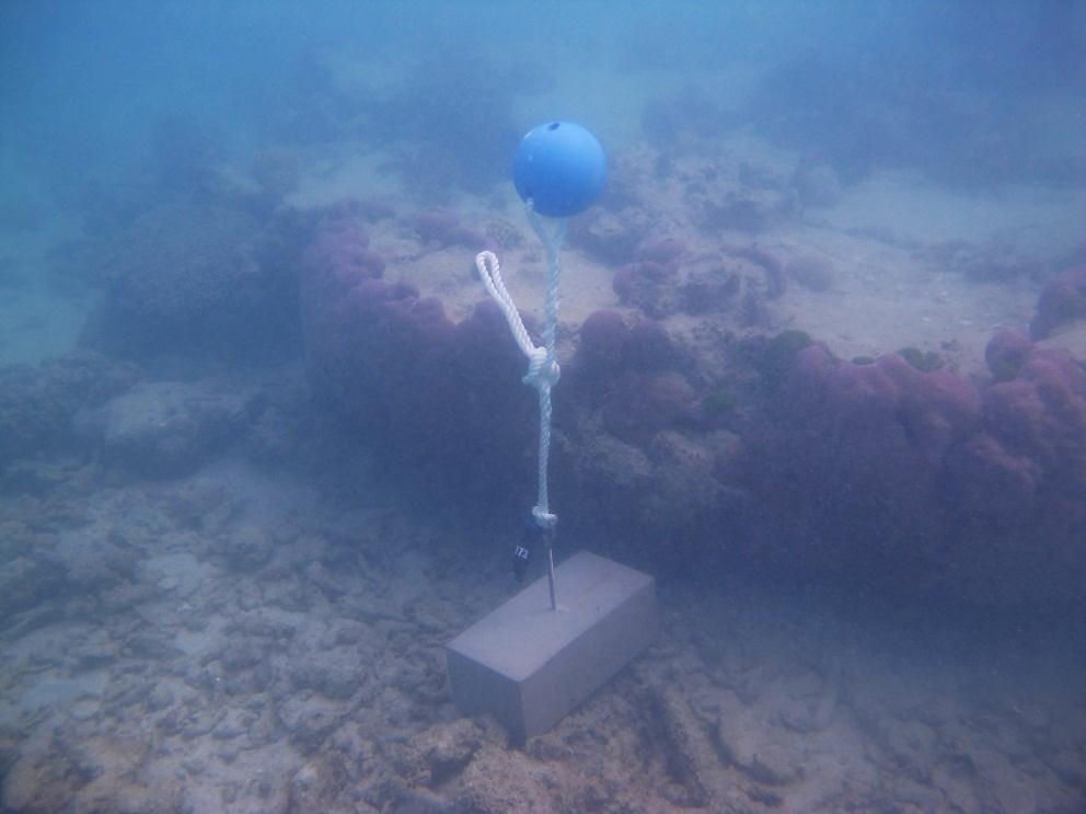
This photo shows the location of the temperature logger at Dugong Island started on 03/10/2012.
GPS position: 10°31.058’S 143°05.983’E on WGS84 datum Depth: 1.9 m at mean tide. Logger on a masonry block on the reef flat approx. 35m further out from the flat logger. It is next to a large Porites bommie which is dead on top.