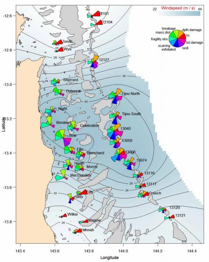
Estimates of damage inflicted by TC Ingrid

©
Description
Map of the study region, and estimates of damage inflicted by TC Ingrid on the 32 study reefs. The 18 reefs near the coast are classified as inshore reefs, while the 14 reefs on the outer edge of the continental shelf are offshore reefs. The red line indicates the path of TC Ingrid, with time displayed as coordinated universal time (UTC). The contours indicate modeled 10-min averaged maximum wind speeds (in m s-1). Displayed in the pie charts are values of the some of the measures of cyclone disturbance (Table 1), as well as hard coral cover (% HC), depth of damage, and fragility (highest values being least fragile). The lengths of the pie segments represent reef-averaged values, and are scaled 0 to 1.


