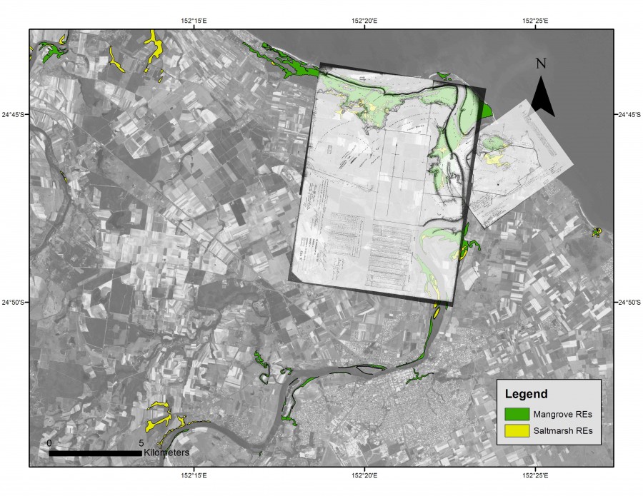
Historical map of Burnett River overlaid on satellite image

Description
The 1869-70 charts of the Burnett River (sourced by Merv Hopton) laid over the 2008-10 satellite image show more specific changes, and a number of features that have remained largely unchanged. Landward and seaward margins of mangrove areas along the Hervey Bay shoreline appear notably comparable. The northern mouth was blocked off with a rock wall and has now filled with sediments occupied by mangroves. There are also indications of an earlier single river mouth between the two – in alignment with a large mangrove-filled ox-bow area on the western side just upstream from the mouth.


