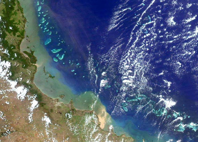
Flood plume MODIS satellite image
Image
Licence
©
courtesy
NASA MODIS Imagery, processed by M.Slivkoff
Description
Satellite images will be used to determine spatial and temporal patterns in water clarity. Here a MODIS satellite image taken on 10 February 2007, when moderate river floods reduced water clarity along the GBR coast.