
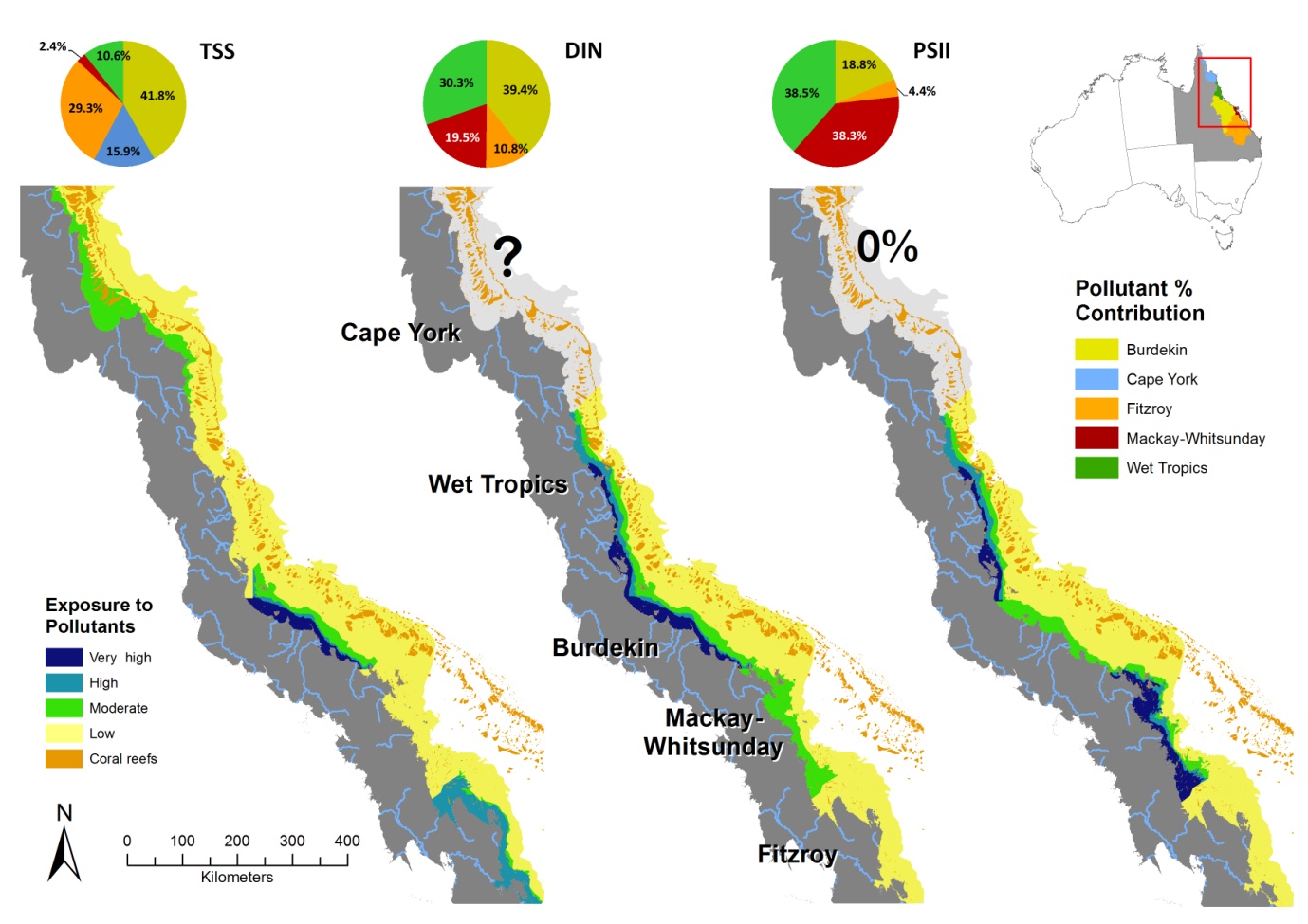
Map of pollutant surface exposure (TSS, chl-a and PSII herbicides) on the GBR coast
Image
Licence
©
All rights reserved
Description
The distribution of the four categories of surface exposure for each of the pollutants (TSS, chl-a and PSII herbicides). Exposure is scaled from high to low with the highest exposure related to the highest flood plume extents (> 10) and the highest pollutant loads. Note that there is no exposure to PSII herbicides in Cape York water due to the very low area of fertilised agriculture. DIN loads in Cape York have very high levels of uncertainty and are not reported here.