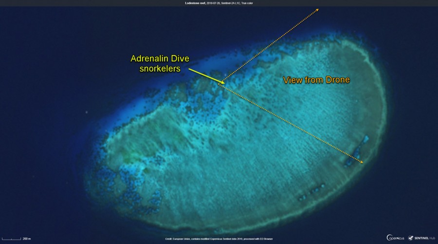
Lodestone reef - Satellite image

Download original image by Eric Lawrey, European Union, contains modified Copernicus Sentinel data 2018, processed with EO Browser
Description
This image shows a satellite image of Lodestone reef showing the rough location of the Adrenalin Dive visits. This reef does not have high resolution imagery on Google Earth and so this imagery is taken from the Sentinel-2 satellite. It is only 10 m in resolution making it difficult to match up with the drone footage taken by the tour operator with the location on the reef. This map shows the best estimate of the location that the tourist opertor was positioned on the day the drone footage was taken. Note that in this image the white dot just north of the location where the snorkelers arrow is on the map is likely to be the Adrenalin Dive boat (on a different day to the drone footage).


