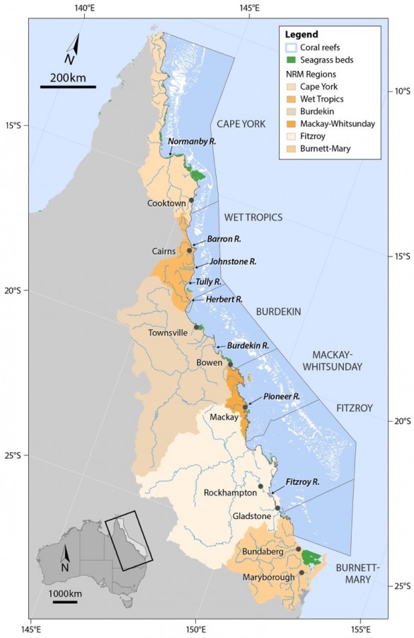
Map of Great Barrier Reef regions

© courtesy McKenzie et al. 2018
Description
Mapped seagrass meadows of the Great Barrier reef, the Natural Resource Management regions and the Great Barrier Reef boundary. Fifty eight sites at 29 locations are assessed including nine coastal, four estuarine and twelve reef locations (i.e. two or three sites at each location). The inshore seagrass component of the MMP assessed seagrass abundance (per cent cover), reproductive effort, and leaf tissue nutrients from inshore seagrass meadows at 29 locations across the GBR. These three indicators are scored for each of the six Natural Resource Management regions for the annual Reef Plan report card.
Image produced for the project


