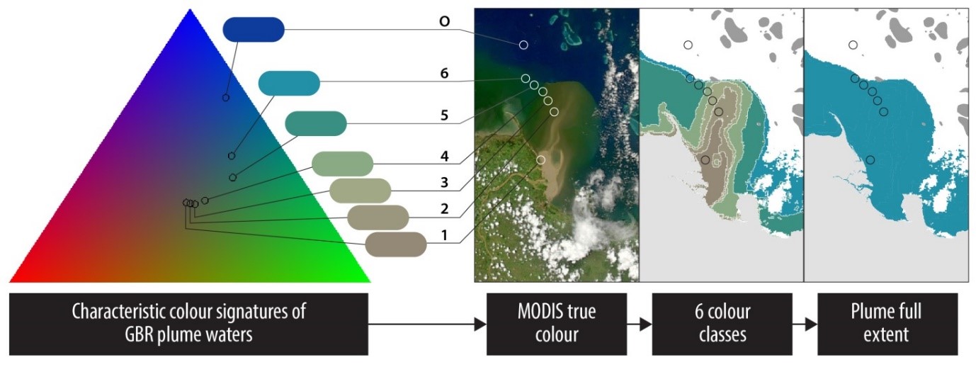
Mapping flood plumes from water colour
Image
Licence
©
courtesy
Devlin et al. (2015)
Description
Triangular colour plot showing the characteristic colour signatures of the GBR wet season waters in the Red-Green-Blue (or true colour) space. A remote sensing method has been developed to map these characteristic coastal water types in the GBR using a supervised classification of MODIS true colour data.
From:
Devlin, M., Petus, C., Teixeira da Silva, E., Tracey. D., Wolff, N., Waterhouse, J., Brodie, J., 2015. Water Quality and River Plume monitoring in the Great Barrier Reef: An Overview of Methods Based on Ocean Colour Satellite Data. Remote Sens. 7, 12909-12941; doi:10.3390/rs71012909