
Wet season water quality monitoring products derived from remote sensing on GBR
Image
Licence
©
courtesy
Devlin et al. (2015)
Description
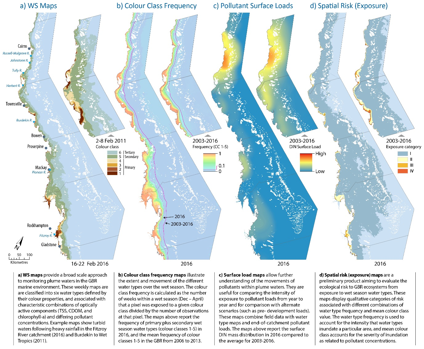
Summary description of the wet season water quality products derived from remote sensing information in the Marine Monitoring Program (MMP) illustrated using outputs from the 2016 wet season.
These include:
- Wet Season maps that provide a broad scale approach to monitoring plume waters in the GBR marine environment.
- Colour class frequency maps that illustrate the extent and movement of the difference water types of the wet season.
- Surface load maps that allow further understanding of the movements of pollutants within the plume waters.
- Spatial risk (exposure) maps that are a preliminary product aiming to evaluate the ecological risk to the GBR ecosystems from exposure to wet season water types.
Devlin, M., Petus, C., Teixeira da Silva, E., Tracey. D., Wolff, N., Waterhouse, J., Brodie, J., 2015. Water Quality and River Plume monitoring in the Great Barrier Reef: An Overview of Methods Based on Ocean Colour Satellite Data. Remote Sens. 7, 12909-12941; doi:10.3390/rs71012909