Flood Plume from Fly River (Landsat 5)
Image
Licence
Download original image
 Eric Lawrey, Australian Institute of Marine Science; Landsat 5 data courtesy of NASA/USGS Landsat Program
Eric Lawrey, Australian Institute of Marine Science; Landsat 5 data courtesy of NASA/USGS Landsat Program
Description
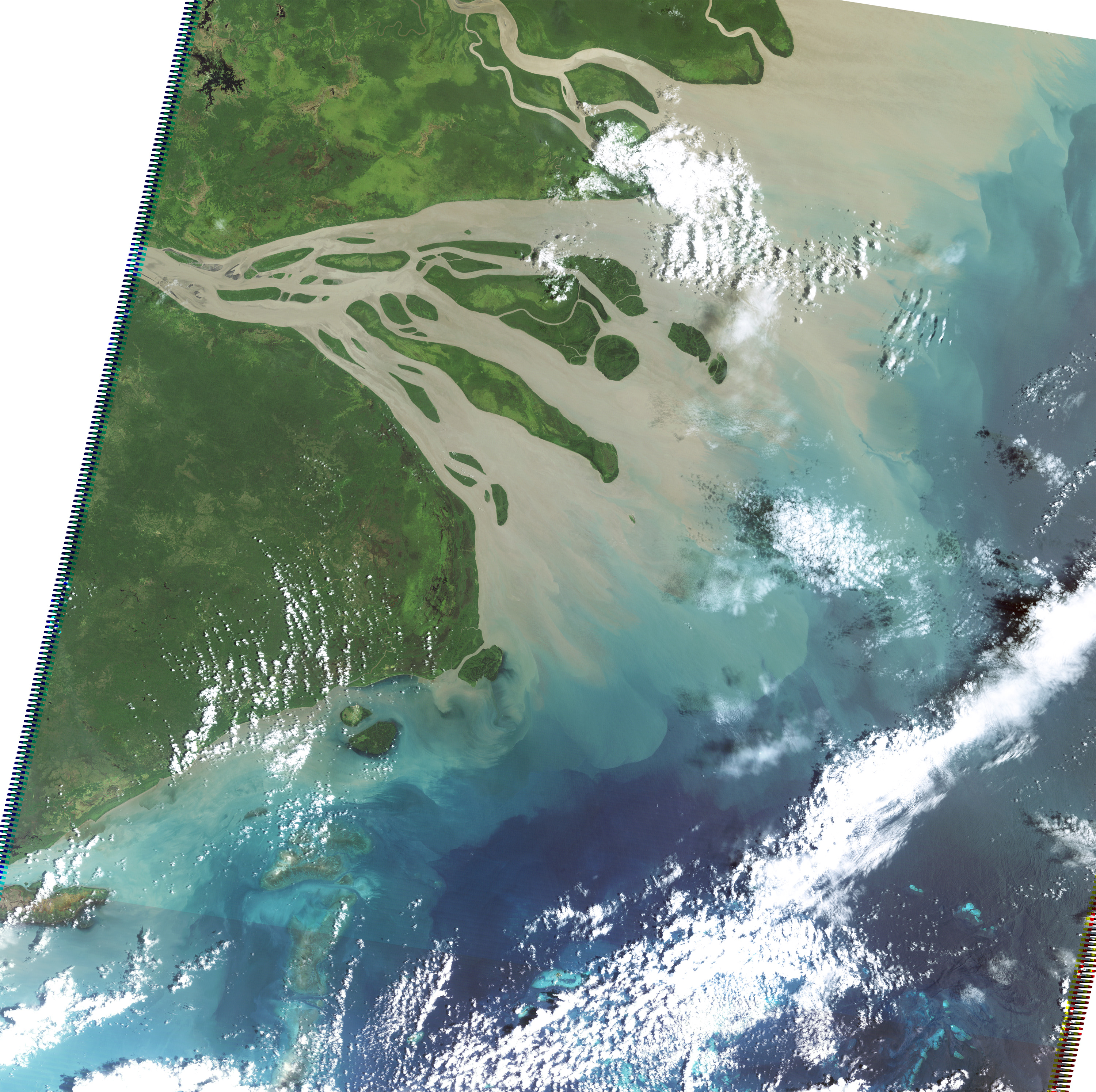
This satellite image (Landsat 5) shows a fairly typical flood plume from the Fly River in PNG on 11th Feb 2009. The plume mostly extends northward away from the Torres Strait, however a percentage hugs the PNG coastline reaching Saibai Island.