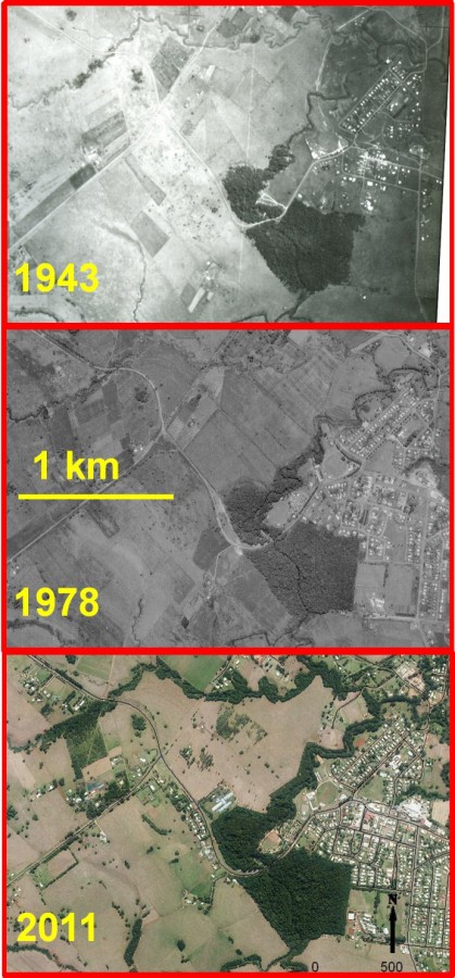
Wet Tropics uplands regrowth over 68 years, Malanda region

© courtesy Carla Catterall (GU), Kylie Freebody (GU), Luke Shoo (UQ)
Notes
Provided by third party. Permission obtained to put on the e-Atlas. Do not redistribute.
Description
Results of recent rainforest replanting as seen in these aerial photos showing land cover change during 68 years in the Wet Tropics uplands – Malanda region. Replanting efforts have focused on re-establishing corridors of riparian rainforest, in former pasture along streams connecting to the Malanda Falls Environmental Park (the rainforest remnant patch visible in all years). The North Johnstone River runs through the Park; where it flows out of the Park's NE corner its banks were planted in 1994 by the Eacham Shire Wet Tropics Tree Planting Scheme (WTTPS), and the riverbanks outside the Park's SW corner (partly visible at the photo's southern edge) were planted between 1996 and 1999 in a cooperative project between the WTTPS and Malanda and Upper Johnstone Landcare Catchment Association. Cleminson Creek in the northern part of the photos was planted between 1993 and 1999 by the Eacham Shire Wet Tropics Tree Planting Scheme (WTTPS). By 2011 these revegetated corridors, were 12-18 years old, and formed a network several kilometres long, of tall dense vegetation containing a diversity of native rainforest tree and shrub species.


