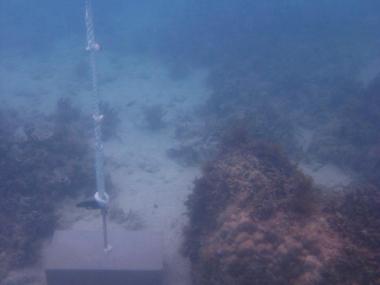
Description
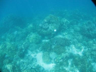
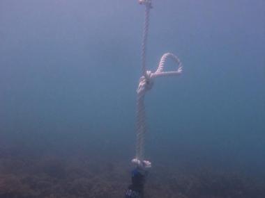
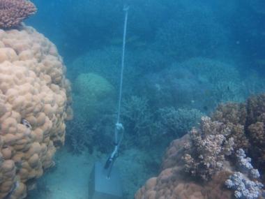
This photo shows the location of the temperature logger at Woiz Reef started on 06/10/2012.
GPS position: 10°10.462S 143°13.584’E on WGS84 datum Depth: 2.5 m at mean tide 0.6 m at datum (Zuizin Rf) Logger located on a concrete block in a sandy area on the reef among scattered small Porites.
 Dr Ray Berkelmans (Australian Institute of Marine Science)
As part of the NERP TE project 2.3 temperature loggers were deployed at 15 sites across the Torres Strait to measure ocean temperature. The loggers regularly (every 10 minutes) measure the sea water temperature and record it in their memory. Every year or so the loggers are swapped with new loggers and the recorded data is extracted and recorded in the AIMS Real Time Data Systems database as part of the Australia wide Sea Temperature Observing System.
While these loggers do not provide real time data, they provide a vital historical record of conditions across Torres Strait allowing researchers to better understand potential temperature thresholds that might cause coral bleaching. The loggers are relatively cheap and easy to deploy allowing a large number to be located across the Torres Strait. They act a silent monitors recording conditions to allow a better understanding of warm water events as well as providing information to help calibrate satellite measurements of sea temperature.
At each site loggers were placed at two depths and were located close to islands or cays to facilitate easy maintenance and replacement.
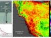
The following map shows the locations of the loggers for which data has been collected. Clicking on any of the sites on the map will create a popup with a link to the data for that site.
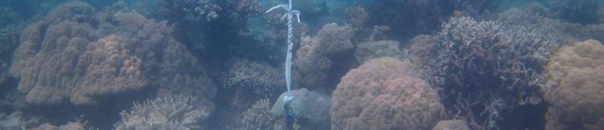
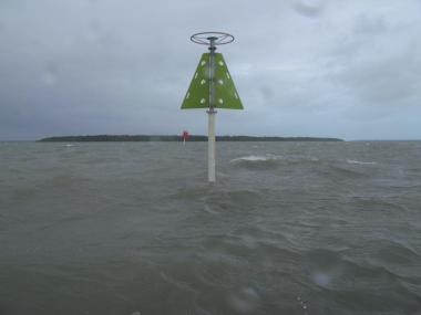
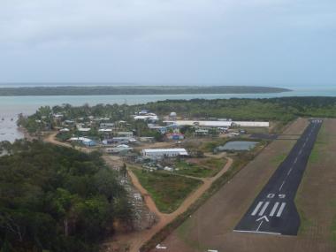
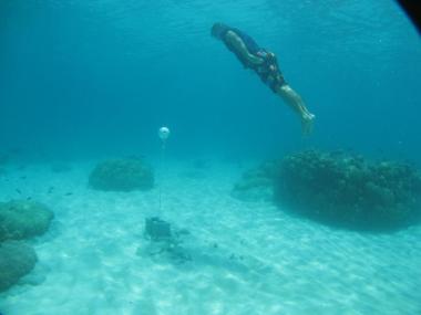
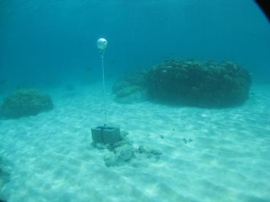
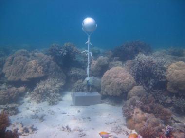
The following photos show the locations of the loggers and are intended to assist with locating the loggers for replacement.
Boigu
 Dr Ray Berkelmans (Australian Institute of Marine Science)
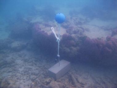
Description
This photo shows the location of the temperature logger at Booby Island.
Shallow logger: Depth: 0.5 m at mean tide. Deep logger: Depth: 3.0m at mean tide. Both loggers are attached to a rope tied around the starboard entrance marker to the channel leading to the barge ramp. The end of the rope is tied to a block.
 Dr Ray Berkelmans (Australian Institute of Marine Science)
Description
Booby Island
 Dr Ray Berkelmans (Australian Institute of Marine Science)
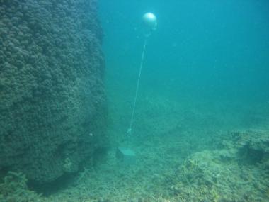
Description
This photo shows the location of the temperature logger at Booby Island started on 03/10/2012.
10°36.187’S 141°54.677’E on WGS84 datum Depth: 1.9 m at mean tide This logger may dry at LAT Logger located on a concrete block at the end of a pair of rail tracks among soft coral. It is approx. 25m from the boat ramp.
 Dr Ray Berkelmans (Australian Institute of Marine Science)
Description
This photo shows the location of the temperature logger at Booby Island started on 03/10/2012.
GPS position: 09°08.383’S 143°52.553’E on WGS84 datum Depth: 2.0 m at mean tide. This logger may dry at LAT. Logger on a concrete block on the reef flat approx. 8m further out from the flat logger. A single rail track leads to it.
Bramble Cay
 Dr Ray Berkelmans (Australian Institute of Marine Science)
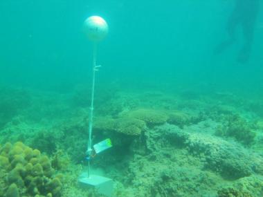
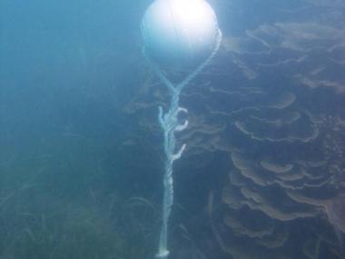
Description
This photo shows the location of the temperature logger at Bramble Cay started on 13/12/2011.
These pictures were taken on a high tide when the depth was around 3.7m
 Dr Ray Berkelmans (Australian Institute of Marine Science)
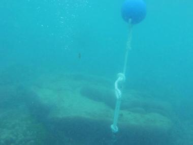
Description
This photo shows the location of the temperature logger at Bramble Cay started on 13/12/2011.
GPS position: 09°08.409’S 143°52.518’E on WGS84 datum Depth: 3.5 m at mean tide 0.8 m at datum (Bramble Cay) Logger located on a masonry block in a sandy area on the reef flat with interspersed Porites bommies.
 Dr Ray Berkelmans (Australian Institute of Marine Science)
Description
This photo shows the location of the temperature logger at Bramble Cay started on 13/12/2011.
This photo shows what it looks like from the surface. Photos taken at high tide when the depth was around 4.5m
 Dr Ray Berkelmans (Australian Institute of Marine Science)
Description
This photo shows the location of the temperature logger at Bramble Cay started on 13/12/2011.
GPS position: 09°08.383’S 143°52.553’E on WGS84 datum Depth: 3.3m m at mean tide 1.6 m at datum (Bramble Cay) Logger on a masonry block on the upper reef slope among scattered soft coral, encrusting and massive hard coral.
Cherepo Island
 Dr Ray Berkelmans (Australian Institute of Marine Science)
Description
This photo shows the location of the temperature logger at Cherepo Island started on 03/10/2012.
GPS position: 10°41.360’S 142°16.794’E on WGS84 datum Depth: 1.6 m at mean tide This logger may be exposed at LAT Logger located on a concrete block next to a small bommie covered in soft coral.
 Dr Ray Berkelmans (Australian Institute of Marine Science)
Description
This photo shows the location of the temperature logger at Cherepo Island started on 03/10/2012.
GPS position: 10°41.370’S 142°16.758’E on WGS84 datum Depth: 2 m at mean tide Logger on a concrete block on a narrow ledge just below the reef flat among short staghorn coral.
Dugong Island
 Dr Ray Berkelmans (Australian Institute of Marine Science)
Description
This photo shows the location of the temperature logger at Dugong Island started on 03/10/2012.
10°31.078’S 143°05.981 on WGS84 datum Depth: 1.6 m at mean tide This logger may dry at LAT Logger located on a masonry block next to a small Porites bommie, approx. 60m off the beach.
 Dr Ray Berkelmans (Australian Institute of Marine Science)
Description
This photo shows the location of the temperature logger at Dugong Island started on 03/10/2012.
GPS position: 10°31.058’S 143°05.983’E on WGS84 datum Depth: 1.9 m at mean tide. Logger on a masonry block on the reef flat approx. 35m further out from the flat logger. It is next to a large Porites bommie which is dead on top.
Iama (Yam) Island
 Dr Ray Berkelmans (Australian Institute of Marine Science)
Description
This photo shows the location of the temperature logger at Iama Island - Yam.
GPS position: 09°53.562’S 142°45.806’E on WGS84 datum Depth: 4m at mean tide 1.6 m at datum (Iama Is) Logger on a concrete block next to a large Porites bommie. 0.1 m at datum (Iama Is) Logger located on a concrete block in a sandy area on the reef flat next a plating Acropora.
 Dr Ray Berkelmans (Australian Institute of Marine Science)
Description
This photo shows the location of the temperature logger at Iama Island - Yam.
GPS position: 09°53.549S 142°45.848’E on WGS84 datum Depth: 2.6 m at mean tide 0.1 m at datum (Iama Is) Logger located on a concrete block in a sandy area on the reef flat next a plating Acropora.
Mabuiag Island
 Dr Ray Berkelmans (Australian Institute of Marine Science)
Description
This photo shows the location of the temperature logger at Mabuiag Island started on 04/10/2012.
GPS position: 9°57.034’S 142°12.265’E on WGS84 datum Depth: 1.9 m at mean tide. Approx. 0.2m below LAT (Talab Island) Logger on a concrete block just below the reef flat approx. 20m further out from the flat logger. It is among short bushy Acropora and rubble.
 Dr Ray Berkelmans (Australian Institute of Marine Science)
Description
This photo shows the location of the temperature logger at Mabuiag Island started on 04/10/2012.
9°57.039’S 142°12.276’E on WGS84 datum Depth: 1.4 m at mean tide. This logger may be exposed at LAT Logger located on a concrete block on the reef flat next to a small dead bommie, close to the reef edge.
Mer Island
 Dr Ray Berkelmans (Australian Institute of Marine Science)
Description
This photo shows the location of the temperature logger at Mer Island started on 05/10/2012.
GPS position: 09°54.788’S 144°02.417’E on WGS84 datum Depth: 3.8m at mean tide 2.4 m at datum (Mer Is) Logger on a concrete block just off the reef edge among soft coral.
 Dr Ray Berkelmans (Australian Institute of Marine Science)
Description
This photo shows the location of the temperature logger at Mer Island started on 05/10/2012.
GPS position: 09°54.801’S 144°02.434’E on WGS84 datum Depth: 2.3 m at mean tide 0.9 m at datum (Mer Is) Logger located on a concrete block in a sandy area on the reef flat next to a large flat Porites bommie.
Moa Island
 Dr Ray Berkelmans (Australian Institute of Marine Science)
Description
This photo shows the location of the temperature logger at Moa Island - Kubin started on 04/10/2012.
GPS position: 10°14.331’S 142°13.056’E on WGS84 datum Depth: 1.8 m at mean tide, approx. at LAT Logger located on a concrete block on the reef flat among short branching coral, close to the reef edge.
 Dr Ray Berkelmans (Australian Institute of Marine Science)
Description
This photo shows the location of the temperature logger at Moa Island - Kubin started on 04/10/2012.
GPS position: 10°14.331’S 142°13.054’E on WGS84 datum Depth: 2.5 m at mean tide. Approx. 0.2m below LAT (Moa Island) Logger on a concrete block just below the reef flat approx. 4m further out from the flat logger. It is next to a large stand of plating/foliose coral (Montipora sp).
Twin Island
 Dr Ray Berkelmans (Australian Institute of Marine Science)
Description
This photo shows the location of the temperature logger at Twin Island started on 03/10/2012.
GPS position: 10°27.784’S 142°26.145’E on WGS84 datum Depth: 2.0 m at mean tide. Approx. 0.2m below LAT (Twin Island) Logger on a masonry block on the reef flat approx. 15m further out from the flat logger. It is next to a large Goniastrea bommie which is dead on top.
 Dr Ray Berkelmans (Australian Institute of Marine Science)
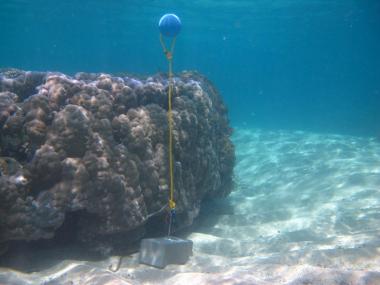
Description
This photo shows the location of the temperature logger at Twin Island started on 03/10/2012.
10°27.775’S 142°26.149E on WGS84 datum Depth: 1.8 m at mean tide, approx. at LAT Logger located on a masonry block next to the first remnants of lice coral, approx. 40m off the beach.
Warraber Island
 Dr Ray Berkelmans (Australian Institute of Marine Science)
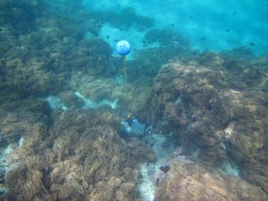
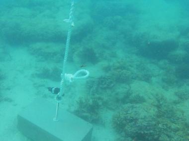
Description
This photo shows the location of the temperature logger at Warraber Island started on 06/10/2012.
GPS position: 10°12.041’S 142°49.136’E on WGS84 datum Depth: 4.8m at mean tide 2.7 m at datum (Poll Is) Logger on a concrete block within 2m of a small Porites bommie.
Woiz Reef
 Dr Ray Berkelmans (Australian Institute of Marine Science)
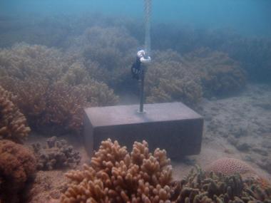
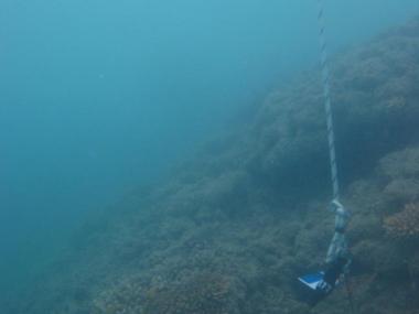
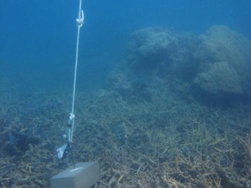
Description
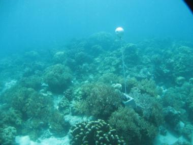
This photo shows the location of the temperature logger at Woiz Reef started on 06/10/2012.
GPS position: 10°10.446’S 143°13.560’E on WGS84 datum Depth: 4.8m at mean tide 2.9 m at datum (Zuizin Rf) Logger on a concrete block next to a Porites bommie on the upper reef slope.
 Dr Ray Berkelmans (Australian Institute of Marine Science)
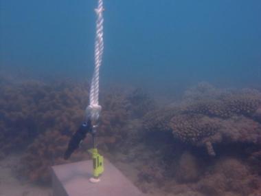
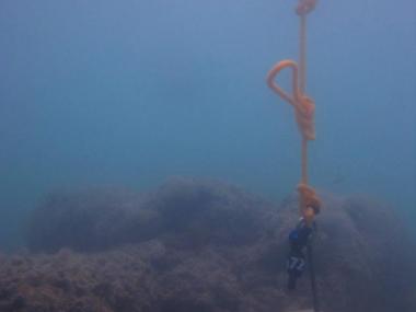
Description
This photo shows the location of the temperature logger at Woiz Reef started on 06/10/2012.
GPS position: 10°10.462S 143°13.584’E on WGS84 datum Depth: 2.5 m at mean tide 0.6 m at datum (Zuizin Rf) Logger located on a concrete block in a sandy area on the reef among scattered small Porites.