TRaCK (Tropical Rivers and Coastal Knowledge) Digital Atlas

TRaCK (Tropical Rivers and Coastal Knowledge) is a research hub which has drawn together more than 70 of Australia's leading social, cultural, environmental and economic researchers. Our research focuses on the tropical north of Australia from Cape York to Broome.
The TRaCK Digital Atlas has been developed to provide a durable and centralised metadata repository for all of TRaCK’s significant intellectual output. Using a spatial (map-based) search and display interface, users will be able to easily discover and access research material produced by TRaCK. By linking TRaCK’s bibliography to the Atlas users can access listings for textual assets (eg journal articles) as well as data layers and maps.
Map layers in the e-Atlas
The mapping layers from the TRaCK Digital Atlas is also available in the e-Atlas and can now be used with any of the other e-Atlas map layers.
To view the TRaCK layers open the e-Atlas mapping client, click the "+" button and choose the layers from the "TRaCK" tab.
Fish Atlas in e-Atlas
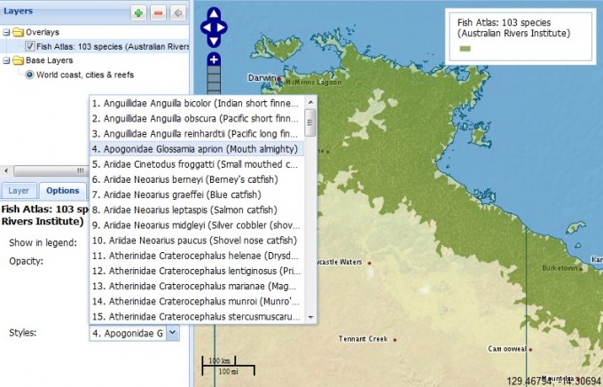
The layers from the Fish Atlas from the "Freshwater fish species distributions in tropical northern rivers" dataset are available by adding the Fish Atlas: 103 species (Australian Rivers Institute) layer then choosing the species of interest in the Style drop down of the Option tab, as shown below:


