AIMS acknowledges the Yinggarda, Baiyungu, Thalanyji, Yaburara, Mardudhunera, Ngarluma/Yindjibarndi, Ngarla, Bindunbur and Bardi Jawi People, as Traditional Owners of the country adjacent to the Ancient Coastline where this Northwest Shores to Shoals work was undertaken. We recognise these People’s ongoing spiritual connection to country and pay our respects to their Aboriginal Elders past, present and emerging.
Key Ecological Features (KEFs) are parts of the marine ecosystem considered to be of particular importance for either a region's biodiversity or its ecosystem function and integrity (see them all). This could relate to a species integral to a community (e.g. a predator that impacts a large biomass or number of species), an important habitat type (e.g. that supports high productivity or aggregations of nesting or breeding animals), or a unique seafloor feature that positively impacts the surrounding ecosystem (e.g. a deep canyon that stimulates upwellings of nutrient rich water).
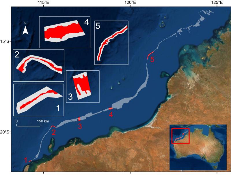
13 KEFs have been defined for Australia’s North-west Marine Region, including the ‘Ancient Coastline at 125m depth contour’ (AC125). The AC125 is thought to “provide areas of hard substrate and therefore may provide sites for higher diversity and enhanced species richness relative to surrounding areas of predominantly soft sediment.”
The North West Shoals to Shore Research Program investigated seabed habitats and their biodiversity to inform management and sustainable development of the region.
Little is known about the fish found on and around the AC125. Part of the reason is that the AC125 is very deep, and thus difficult to observe. One question to ask about a habitat is how many different species of fish are found there - this is called fish species 'richness'. We explored this question for 5 study areas spread along the vast AC125 (see map below, read the full paper here).
We built a spatial predictive model of fish species richness using the Baited Remote Underwater Video (BRUVS) data, depth data collected in this survey and a machine learning analytical approach. [See examples of what we saw on the BRUVS videos.]
The predictive maps below show that species richness was higher in shallower depths beyond the legally defined AC125. The AC125 itself typically features organisms like bryozoans, gorgonians, sponges, and whips, and pockets of seabed where the terrain is structurally complex (such as nooks and crannies that provide shelter to various fish species). The sites deeper than the AC125 typically lack this complexity and are dominated by soft-bottom (mud, silt, sand) habitats with relatively few fish species. Of the 5 study areas, 1 and 2 were predicted to have relatively high species richness on or close to AC125. This may be due to their proximity to Ningaloo Reef (Area 1) or Rankin Bank (Area 2) which are known to have a very high richness of fish species.
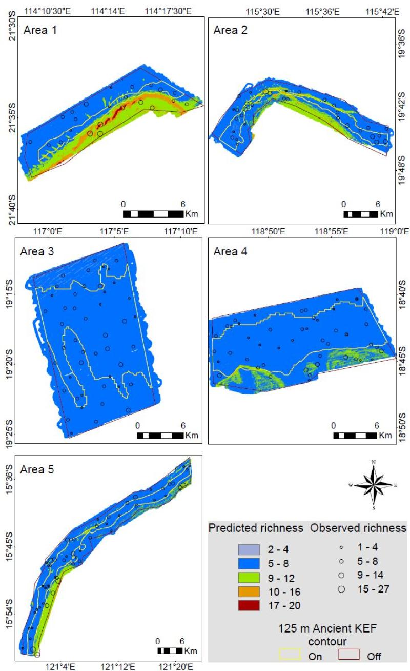
Use the interactive maps below to explore the predicted fish species richness across the five study Areas of AC125.
Legend
KEF Area 1
KEF Area 2
KEF Area 3
KEF Area 4
KEF Area 5
View the metadata - Read the paper
AIMS’ North West Shoals to Shore Research Program is proudly supported by Santos as part of the company’s commitment to better understand Western Australia’s marine environment.