

Where
Norfolk Marine Park
Who
A team of current and past Norfolk Island residents including Dr Kellie Pendoley, Margaret Christian, Mitch Graham and Rob Ryan.
When
2020 – 2022
Why
Prior to this project a habitat map for the marine environment around Norfolk Island had not been developed. Despite various single point source marine surveys being carried out by visiting experts over the years, none of the data had been consolidated into a single source, nor was any of the expertise or knowledge passed onto the local community. This lack of habitat mapping prevented ongoing monitoring of the marine environment and left a large gap in the knowledge used for impact assessment of marine activities around the island.
 Kellie Pendoley
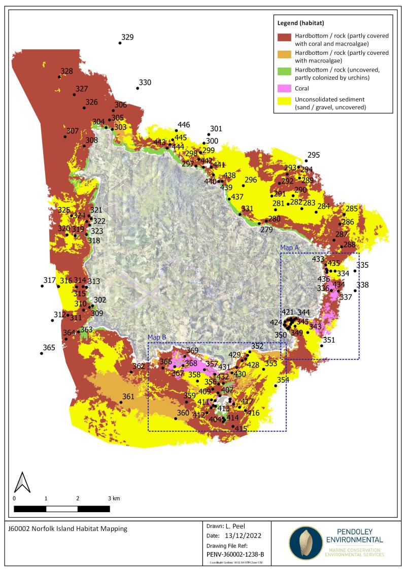
Norfolk Island Marine Park habitat map
How
The project was conducted in six stages:
- Creating a high-level habitat map using satellite imagery and specialised algorithims to assign habitat type classifications (service provided by EOMAP Pty Ltd).
- Undergoing public consultation with local fishermen, surfers and divers at Norfolk Island to get feedback on the accuracy of the habitat classifications.
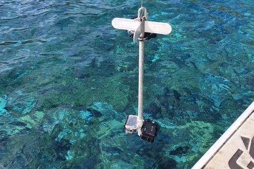
- Ground truthing of the satellite imagery derived maps using a Norfolk Island based team. Survey equipment was built locally on Norfolk Island and was based around a GoPro Hero 9 camera, LED dive lights and an electric fishing rod.
- Processing the ground truthed survey data to assess the accuracy of the habitat classification.
- Modifying and remapping of the habitat types identified in the satellite-image derived map based on the ground truthing field data (by EOMAP).
- Uploading a publicly available habitat map to be hosted on the Norfolk Island Flora and Fauna Society web page, including links to images embedded in the map that can be easily viewed by the general public.
 Kellie Pendoley
Survey equipment used for marine habitat ground-truthing, including a Go Pro hero 9 camera, and an LED light array which was attached to an electric fishing rod.
What did we learn
This high-level habitat map will be used for Marine Park planning purposes, and assessment of development applications and EPBC Act referrals within the nearshore waters of the Norfolk Marine Park.
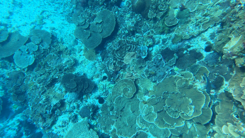
The survey encompassed waters between 2.5 m and 42 m deep and identified several habitat types around Norfolk; hardbottom rock with macroalgae and/or coral, urchin barrens and sandy seabed. Corals were found in waters up to 40m deep. The survey also confirmed that there is no seagrass at Norfolk Island.
 Kellie Pendoley
Coral observed during nearshore habitat mapping within Norfolk Marine Park
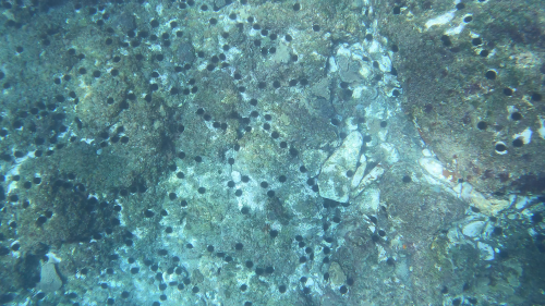
The video footage suggests this temperate coral habitat is characterised by diverse coral and macroalgal assemblages. These habitats are locally modified by relatively high sea urchin populations which have created pockets of urchin barrens around the island.
 Kellie Pendolie
Bare rock with high density urchin barren site
What next
The map will provide a basis for any ongoing marine habitat impact and condition assessments, as well as monitoring. It can also be used as a basis for any development applications in the waters around Norfolk Island. The map can be further refined as more detailed information becomes available from subject matter experts in the future. The capture, collation and storage of data by local residents will ensure the information is retained on the island for future reference.
Related data and publications
The project report can be found on the Norfolk Island Flora and Fauna web site here.
An online Google Earth map with links to images and short video clips of the seabed at the 160 sites surveyed around Norfolk Island can be found on the Norfolk Island Flora and Fauna site here. A LiDar map of the island is also on this site.