This map shows the foraging paths of two nesting shearwater birds that were tracked off Heron Island. The tracks show their foraging trips to collect food for their young.
One of the birds (blue lines) made two short day trips (~75 km from the island) south to collect food. The other bird (purple lines) took a much longer flight south (over 600 km from the island). The track of this bird is broken up as the tracker only operates during the day to save power.
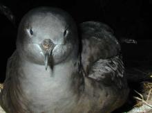
Small GPS trackers were attached to the adults birds and track them during the day, shutting down at the night to conserve power. These trackers show the movement of the bird over approximately a week until the batteries are flat.
The dots on the map show the individual GPS locations recorded by the tracking device.