NERP TE Project 6.3 - Critical seabird foraging locations and trophic relationships for the Great Barrier Reef (JCU)
Project summary
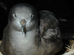
This project will help in the management of seabird populations of the Great Barrier Reef (GBR) and greater Coral Sea areas by providing information about the foraging locations, behaviour, and success of different species. Researchers have trialled and successfully used a range of tracking systems on foraging shearwaters in the southern GBR. From this work they have been able to describe shearwater foraging habitat at near-colony scales and identify the level of prey resources required for successful breeding. Studies in both the northern and southern GBR have provided preliminary data on links between seabird foraging success and specific ocean weather systems and currents. The project has also identified potential overlap between seabird foraging areas and blue-water billfish and tuna fishing activity outside the GBR.
Why this research is needed
Knowing what type of habitats seabirds use to find food and how their foraging success is linked to environmental characteristics, like ocean currents and frontal systems, or to human activities, such as fishing, will make it easier to protect them.
Research-user focus
The project will deliver outcomes that are useful to fisheries, marine park managers and conservation agencies. These organisations include the Great Barrier Reef Marine Park Authority (GBRMPA), the Queensland Department of Environment and Heritage Protection, Queensland Parks and Wildlife Service and the Australian Fisheries Management Authority.
Outcomes
Short-term
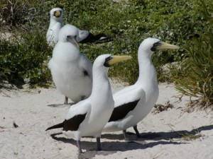
- Maps of shearwater and booby foraging locations during breeding at specific GBR sites.
- A report on overlap in foraging area use among colonies and/or species and a description of the foraging environment at each location.
- Overlays of seabird foraging locations and correlations of foraging success on indexes/charts of commercial fishing activity.
Longer-term
- Maps of shearwater and booby foraging locations during the non-breeding season.
- Correlations between seabird foraging success at different colonies and information on oceanographic parameters, such as currents and weather systems.
Sample Tracks
The following map shows the tracks of two birds short term tracks during the feeding season. The tracks have breaks in them as the GPS trackers switch off at night.
Reports, Publications and News
For more information see Project 6.3 'Critical seabird foraging locations and trophic relationships for the Great Barrier Reef' on the NERP Tropical Ecosystems Hub site.
Datasets

The program aims to identify key foraging locations and biophysical characteristics for shearwaters and boobies in the GBR and Coral Sea, assess prey availability and its climate-driven variations, and understand the conditions necessary for viable reproduction and potential anthropogenic interactions.
Overall the key objectives of this program are to:


