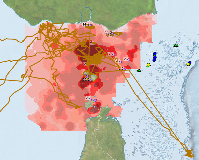
Map of NERP TE data in Torres Strait
Image
Licence

Description
This is a preview of an interactive map showing all spatial data for the NERP TE research projects in Torres Strait. This includes turtle tracking, dugong and turtle relative distribution, reef surveys, and field sites for mangrove surveys and mosquito surveys.