Mabuiag Island - Torres Strait Temperature Logger (Slope Logger: MABUIAGSL1)
Image
Licence

Description
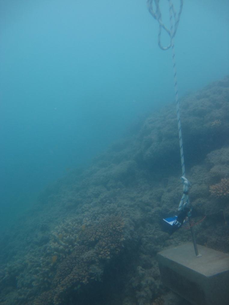
This photo shows the location of the temperature logger at Mabuiag Island started on 04/10/2012.
GPS position: 9°57.034’S 142°12.265’E on WGS84 datum Depth: 1.9 m at mean tide. Approx. 0.2m below LAT (Talab Island) Logger on a concrete block just below the reef flat approx. 20m further out from the flat logger. It is among short bushy Acropora and rubble.