Warraber Island - Torres Strait Temperature Logger (Slope Logger: WARRABERSL1)
Image
Licence

Description
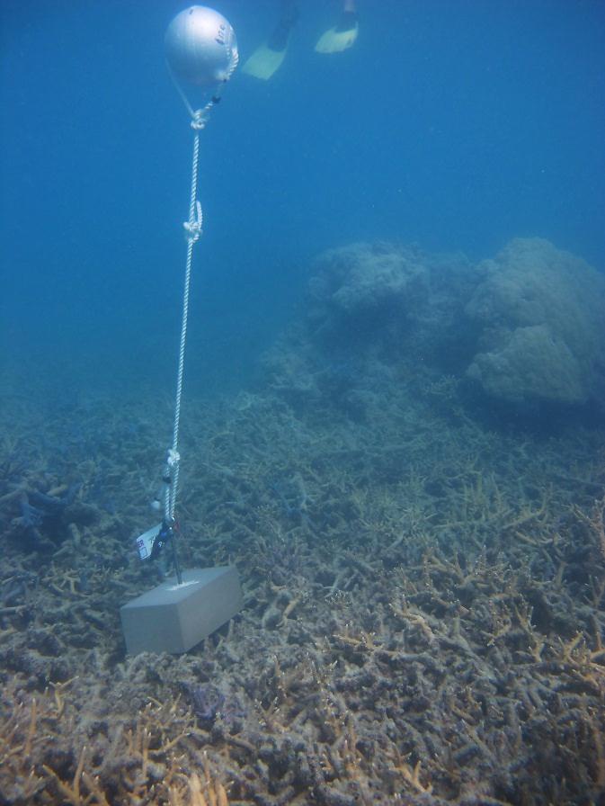
This photo shows the location of the temperature logger at Warraber Island started on 06/10/2012.
GPS position: 10°12.041’S 142°49.136’E on WGS84 datum Depth: 4.8m at mean tide 2.7 m at datum (Poll Is) Logger on a concrete block within 2m of a small Porites bommie.