Modelled oil spill exposure map
Image
Licence
©
All rights reserved
Description
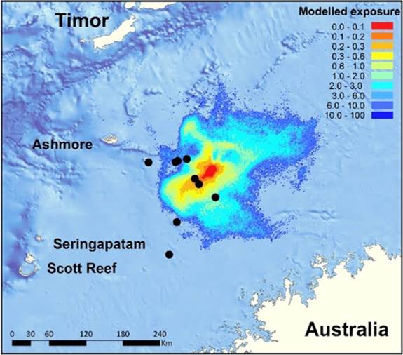
Research examined patterns in the fish community on nine shoals (●) across the oil spill exposure gradient. Figure: Dr Cordelia Moore / PTTEP