
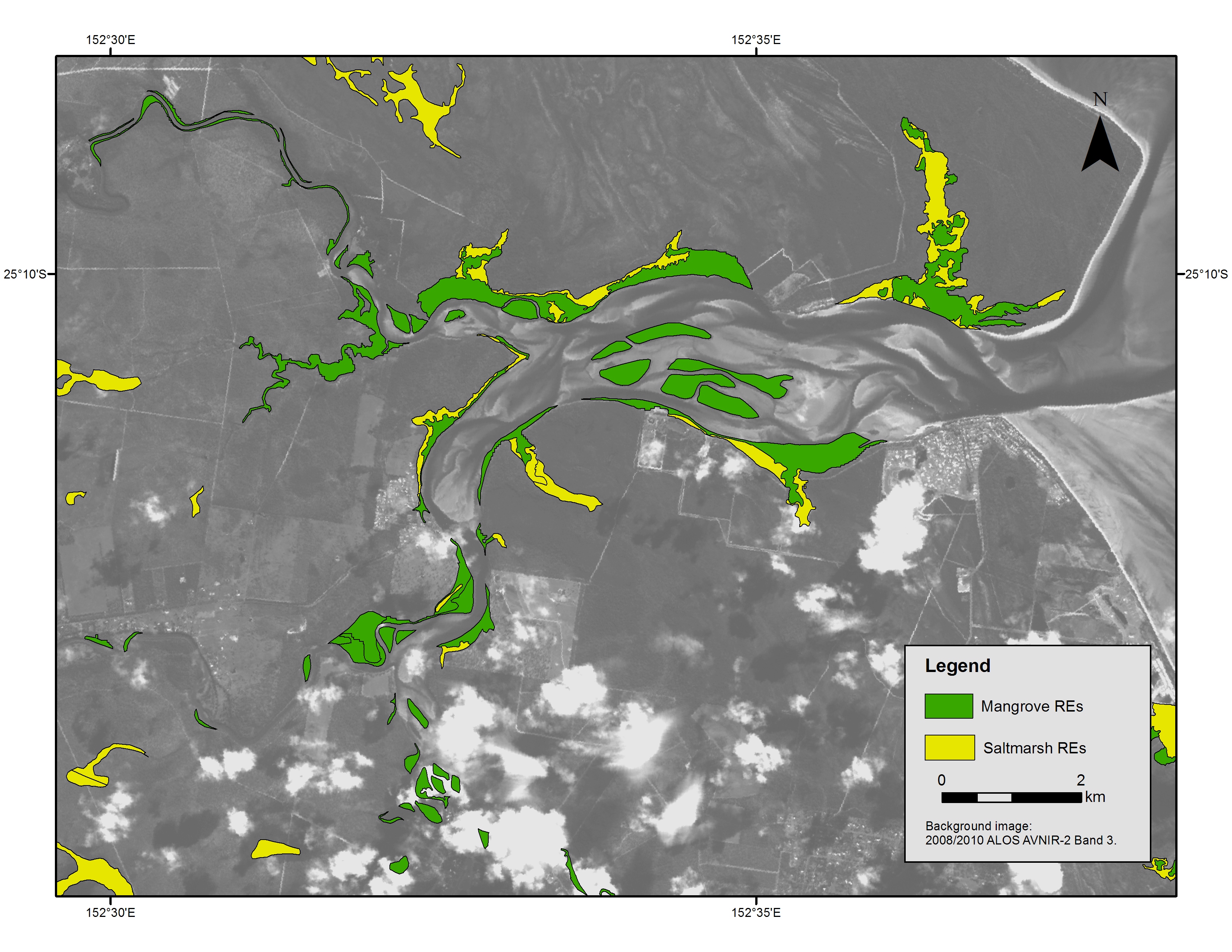
Map of tidal wetlands (mangroves and salmarsh) around Burrum River
Image
Licence

Description
Map of the Burrum River estuarine system pre 2009, showing tidal wetland mangroves (green shading) and tidal saltmarsh (yellow shading). This map shows part of the Southern GBR study area of NESP TWQ project 2.3.4.