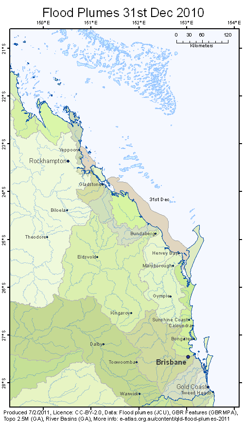
Animation of flood plumes on the Great Barrier Reef due to flooding in Queenland in 2010/2011

©
Description
Animation of the progression of the flood plumes on the Great Barrier Reef caused by heavy rain and flooding in the Queensland in December 2010 and January 2011. This map shows the flood plume from the Brisbane River spreading into Moreton Bay then to the tip of Frasier Island. Flood plumes from the Fitzroy river, the Burnett river and the Mary river travel northward into the Great Barrier Reef.


