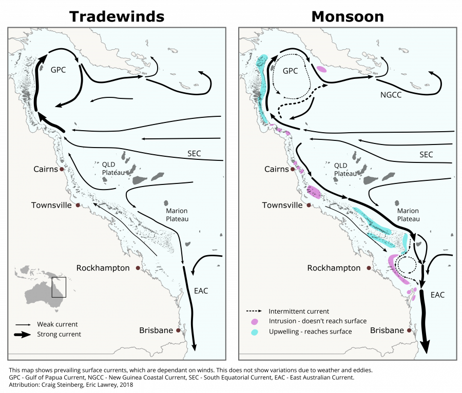
Map diagram of prevailing surface currents in the GBR and Coral Sea in the Monsoon and Tradewind seasons

Description
Seasonal prevailing surface currents of the Western Coral Sea and outer Great Barrier Reef (GBR). It also shows where oceanic upwelling occurs along the GBR.
The main driver of the currents along the Queenland coast are a result of the westward currents near the equator that come off the Pacific Ocean. When the Pacific currents hit obstructions such as reefs and land they are deflected around the obstructions. The main inward flow from the pacific hits close to Lizard Island, north of Cairns, where it is deflected and split north and south forming the Gulf of Papua Current (GPC) and the East Australian Current (EAC). These large scale ocean currents are however pushed by the wind at the surface resulting in seasonal differences in the strength and direction of the surface currents. During the tradewinds season (which tend to occur in the winter months) the wind is consistently pushing north west. This boosts any currents moving northward and slows any southward currents such as the EAC. During the monsoon season (during the summer) the winds reduce and so the ocean currents are almost as though there was no effect from the surface wind.
This map does not show the year to year variability that occurs, or the effects of eddies that can result in water movement in the opposite direction of the prevailing currents. Developed by expert opinion by Craig Steinberg and Eric Lawrey, 2018.


