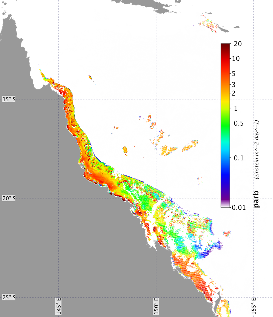
We can now use satellite data to estimate how much light reaches benthic habitats in the Great Barrier Reef
Image
Licence

Description
bPAR (benthic light) map showing the amount of light reaching the bottom of the water column on 1 January 2004, using data derived from NASA’s MODIS satellite and an inherent optical property-based algorithm developed during the course of NESP Tropical Water Quality Project 5.3