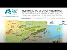
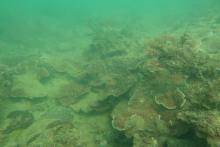
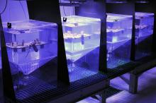
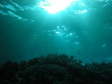
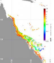
NESP TWQ Round 5 - Project 5.3 – Benthic light as ecologically-validated GBR-wide indicator for water quality: Drivers, thresholds and cumulative risks

Region map

The project is developed a water quality indicator based on benthic PAR (light penetrating to the seafloor). The project experimentally estimated irradiance thresholds for ecosystem health for the Great Barrier Reef and developed a new remote sensing algorithm to estimate and map benthic irradiance throughout the GBR. This fed into Reef Plan report cards, RIMReP monitoring, and assessments of drivers of cumulative risks. The project extension focused on: work with stakeholders to embed the products into their workflows; improved the remote sensing algorithm with seasonal and regional cloud corrections; and evaluated an additional benthic light product based on the eReefs models to complement the remote sensing product.

NESP TWQ Project Page

Images

Videos

Datasets

21 July 2021

This dataset contains annual and seasonal values of the benthic light (bPAR index) for water quality on the Great Barrier Reef as calculated for each NRM Region (Cape York, Wet Tropics, Dry Tropics, Fitzroy and Mary-Burnett) and waterbody (Closed Coastal, Open Coastal, Midshelf and Offshore) for each water year between 2003 and 2019, as reported in NESP TWQ Project 5.3. Code used to produce these values is also available through eAtlas, as is the daily bPAR data.

21 July 2021

This dataset contains code used to generate the daily benthic light (bPAR) data product provided at https://eatlas.org.au/data/uuid/356e7b3c-1508-432e-9d85-263ec8a67cef and the bPAR index for water quality in the Great Barrier Reef (GBR). It can also be used to calculate photosynthetically active radiation (PAR) at any specified depth in GBR waters.

31 March 2021

This dataset contains estimates of diffuse attenuation coefficient (Kd) of downwelling irradiance at different wavelengths (412, 443, 469, 488, 531, 547, 555, 645, 667 and 678 nm) in the Great Barrier Reef Marine Park and Coral Sea for each day from July 2002 through to December 2019. Data are provided on a nominal 1km grid for each wavelength.

31 March 2021

This dataset contains estimated daily integrated benthic photosynthetically active radiation (bPAR) in the Great Barrier Reef Marine Park and Coral Sea for each day from July 2002 through to December 2019. Data are provided on a 1km grid.

10 December 2020

This dataset contains estimated daily integrated photosynthetically active radiation (PAR) at 8 m depth in the Great Barrier Reef Marine Park and Coral Sea for each day from April 2002 through to December 2019. Data are provided on a 1km grid.