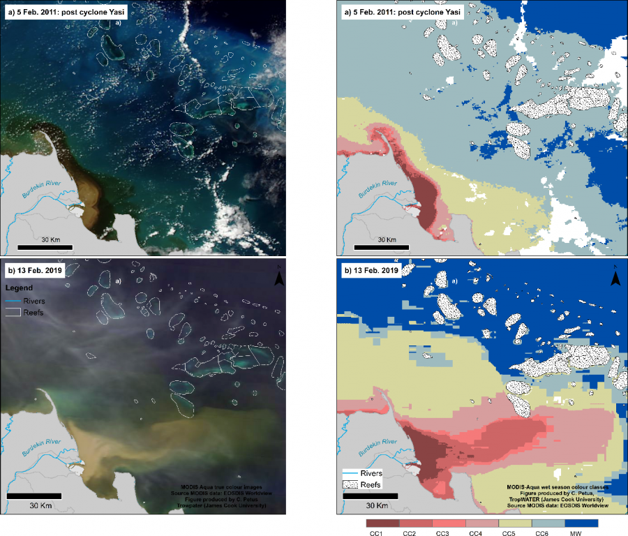
Comparing the 2019 big flood with the 2011 flood from satellite

© courtesy JCU - TropWATER, NASA
Description
True colour satellite images from NASA MODIS satellite highlighting the extent of the Burdekin River plume in the GBR during the 2019 big flood compared to the last big flood event of 2011 (L), and wet season water type maps (R) (Source: EOSDIS Worldview).
In 2019 the flood plume waters were pushed away from the coast from winds blowing eastwards, resulting in the flood plumes reaching some of the nearby reefs such as Old reef. An animation of this plume is visible from the eReefs model.


