Spatial plot example
Image
Licence
©
All rights reserved
Description
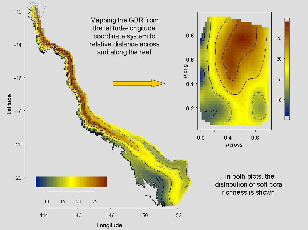
An spatial plot of soft coral richness, using the traditional geodesic coordinate system (latitude - longitude), and for easier viewing, in the coordinate system based on relative distance of a reef across and along the GBR shelf (right).