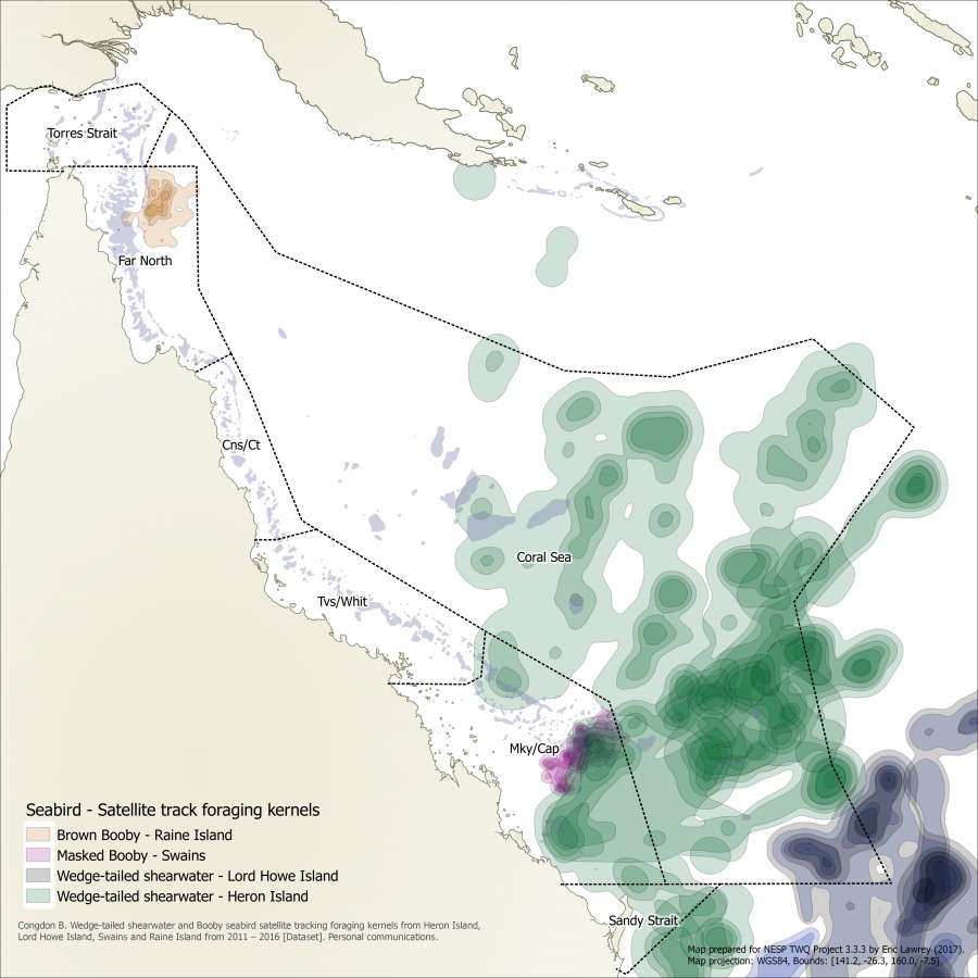
Map of seabird foraging kernels for the Great Barrier Reef and Coral Sea

Description
This map shows the distribution of seabird foraging from birds tagged at four locations (Lord Howe Island, Heron Island, raine Island and Swains). This shows kernels derived from the satellite tracks where darker regions represent areas where the birds spent more time foraging. Brown booby (Sula leucogaster), showing in orange, forage up to 100 km from their nesting site on Raine Island, spending much of their foraging time in the Coral Sea near the edge of the continential shelf where upwelling occurs. The Masked Booby (Sula dactylatra), shown in pink, in the Swains have a similar range. The Wedge-tailed shearwaters (Ardenna pacifica), shown in green and purple, have a much greater foraging range of 1000km venturing far out into the Coral Sea for food. Note: This map only represents the distribution of sea birds monitored from four sites.
The data used for this map was provided by Brad Congdon from monitoring between 2011 and 2016.
McDuie, Fiona, Weeks, Scarla J., Miller, Mark G.R., and Congdon, Bradley C. (2015) Breeding tropical shearwaters use distant foraging sites when self-provisioning. Marine Ornithology, 43. pp. 123-129.


