
Seagrass distribution on the GBR
 Dr Eric Lawrey (eAtlas (Australian Institute of Marine Science)), Mr Len McKenzie (TropWATER), Robert Coles (James Cook University), Alex Carter (James Cook University), Michael Rasheed (James Cook University)
Description
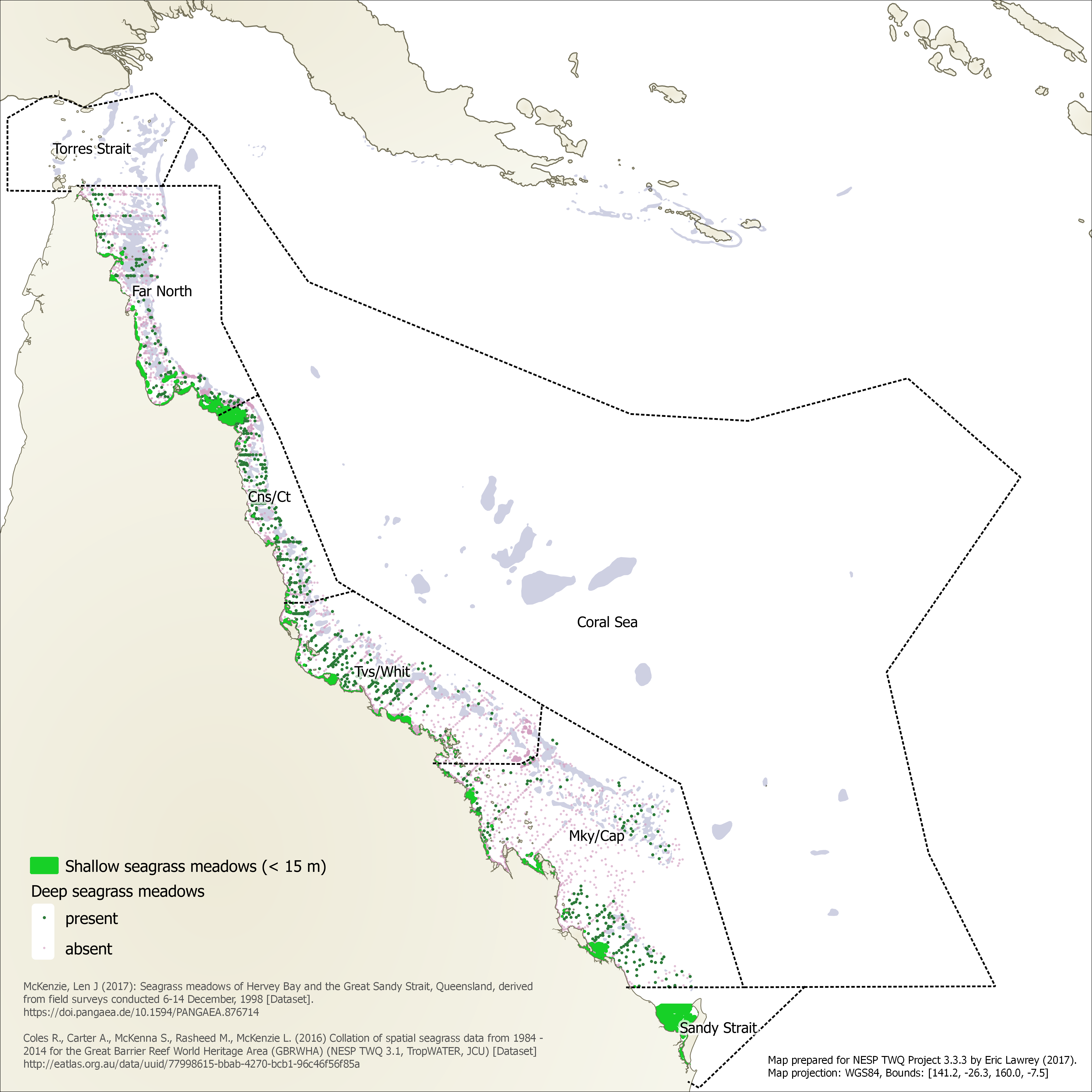
This map shows the distribution of shallow and deep seagrass meadows in the north east Australian seascape up to the tip of Cape York. Note: Torres Strait has a lot of seagrass meadows however these are not shown on this map.
Data use for this map:
McKenzie, L. (2017) Seagrass meadows of Hervey Bay and the Great Sandy Strait, Queensland, derived from field surveys conducted 6-14 December, 1998. Centre for Tropical Water and Aquatic Ecosystem Research, James Cook University, Townsville. PANGAEA. https://doi.org/10.1594/PANGAEA.876714
Coles, R., Carter, A., McKenna, S., Rasheed, M., McKenzie, L. (2016) Collation of spatial seagrass data (meadow extent polygons, species presence/absence points) from 1984 - 2014 for the Great Barrier Reef World Heritage Area (GBRWHA) (NESP TWQ 3.1, TropWATER, JCU) [Dataset]. eAtlas. https://eatlas.org.au/data/uuid/77998615-bbab-4270-bcb1-96c46f56f85a