
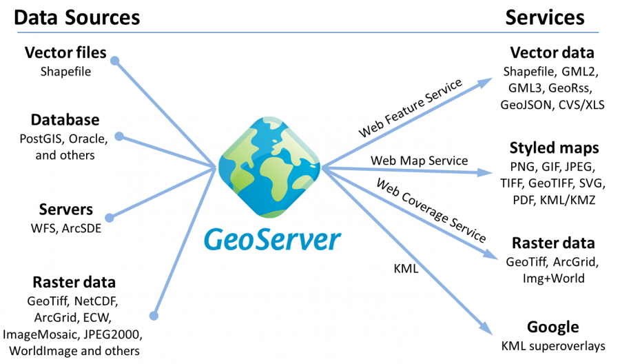
Diagram of data source and services generated by GeoServer
Photographers: Eric Lawrey
Description
GeoServer can input spatial data in a wide variety of format and deliver them in a number of open standards based services. This diagram is based on one produced by boundless.