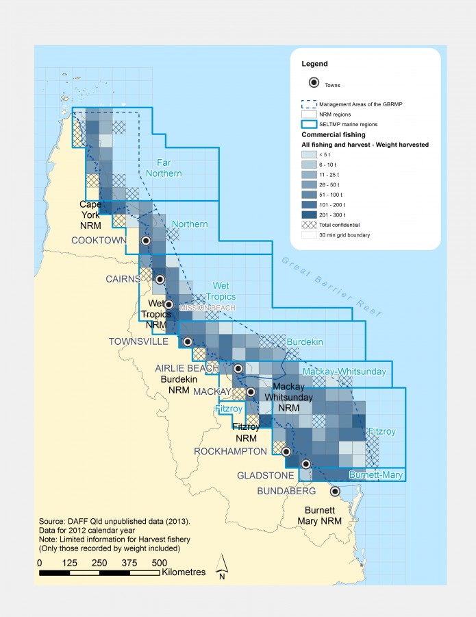
Distribution of commercial fisheries in the GBR (in tonnes)

Photographers: Petina Pert
Description
Distribution map of the commercial fishing and Harvest Fisheries, in the Great Barrier Reef (GBR). The map only includes the catches that has been recorded by weight.
Data for year 2012.
Source: Department of Agriculture, Fisheries and Forestry (DAFF), Queensland (Qld) unpublished data (2013)
Image produced for the project


