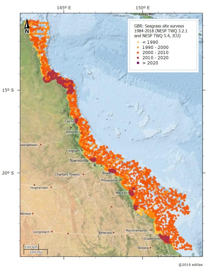
Seagrass Surveys on the GBR showing year of survey in a 10 year timescale

Description
Seagrass survey data compilation collected over 35 years of seagrass data (1984-2018) for the Great Barrier Reef region. This map shows data by survey year using a 10 year time scale. It is important to note the most recent data in the compilation is from 2018. Access the interactive map here.
These data are derived from the dataset: Carter A, Collier C, McKenna S, Rasheed M, Pitcher R, McKenzie L, Cole R. (2020). Seagrass mapping synthesis: A resource for coastal management in the Great Barrier Reef (NESP TWQ Project 3.2.1 and 5.4, TropWATER, James Cook University). eAtlas, Dataset, https://doi.org/10.25909/y1yk-9w85.


