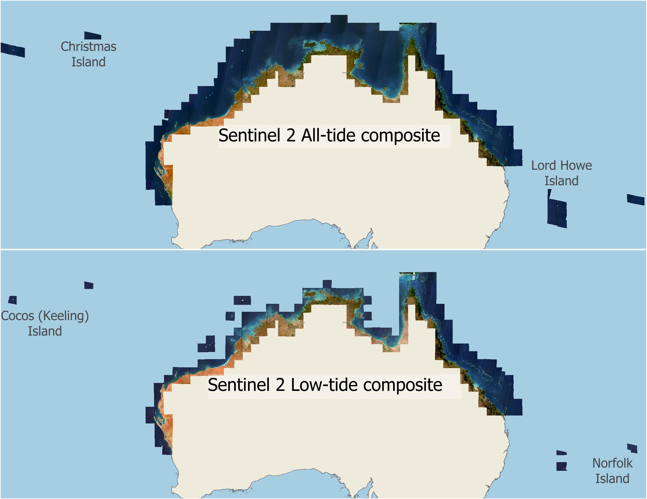
Preview map of the Sentinel 2 All-tide and Low-tide composite imagery datasets
Image
Licence

Description
Map showing the extent of the NESP MaC 3.17 Sentinel 2 composite imagery. The All-tide composite covers offshore areas, whereas the Low-tide composite is restricted to nearshore areas, except in the GBR. The imagery also covers remote islands and reefs in the Indian and Pacific oceans, including Cocos (Keeling) Island, Christmas Island, Lord Howe Island and Norfolk Island.