Comparison between NESP MaC 3.17 Sentinel 2 All-tide imagery and Google Maps, Allen Coral Atlas and ArcGIS World Imagery
Image
Licence

Description
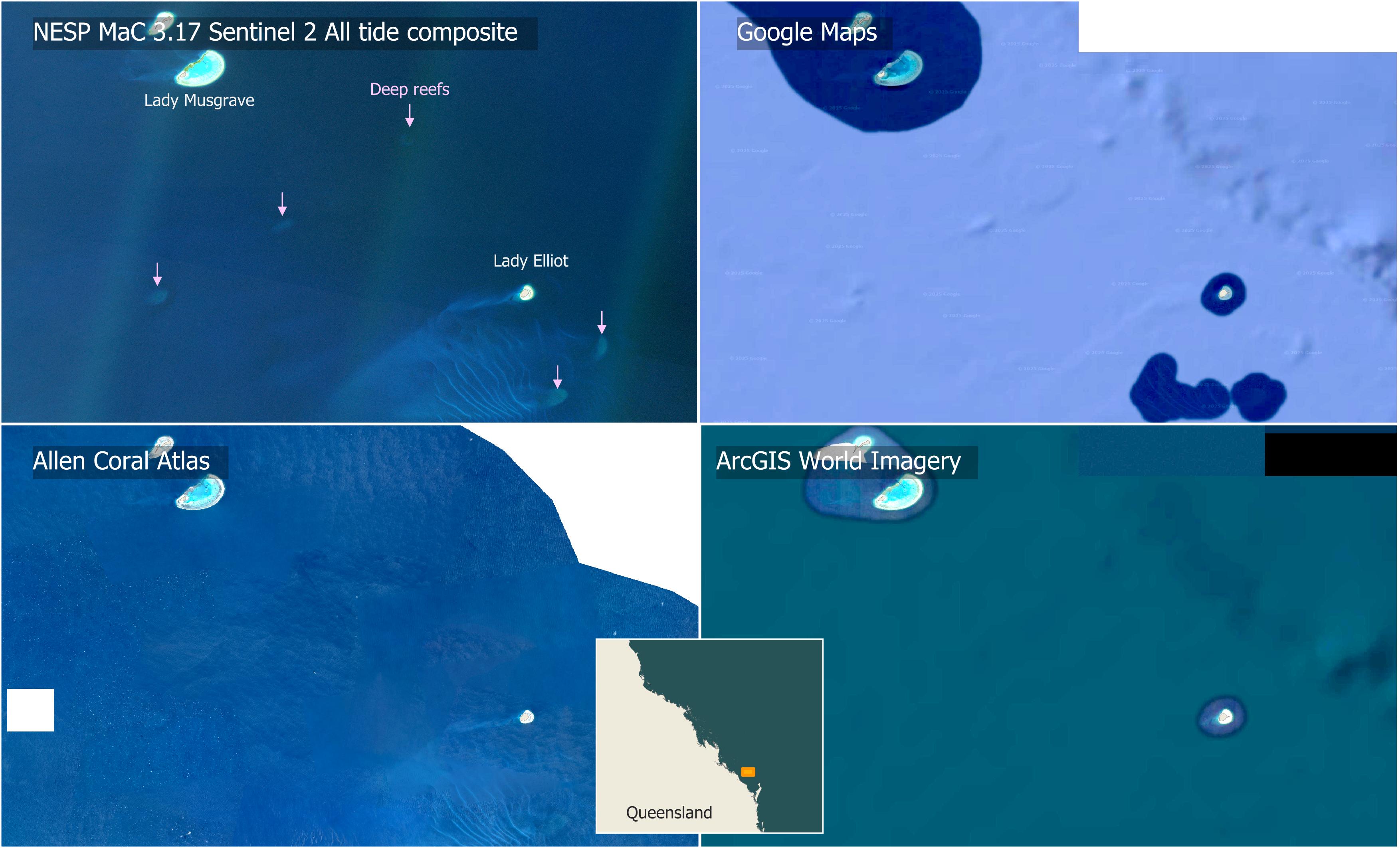
Map highlighting the strengths of the Sentinel 2 All tide composite imagery verses commonly available satellite basemaps. This imagery provides consistent coverage across the Australian marine estate and allows deeper features to be seen. The new imagery reveals that between Lady Musgrave and Lady Elliot in the GBR, there are five deep coral reef shoals not visible in Google Maps, Allen Coral Atlas and ArcGIS World Imagery. Google Maps and ArcGIS World Imagery focus on providing high resolution imagery, but this is typically limited to very shallow waters. The Allen Coral Atlas provides broader coverage and twice the resolution of the Sentinel 2 imagery, but has a higher noise level that limits its depth visibility.