Comparison between NESP MaC 3.17 Sentinel 2 Low tide composite satellite imagery and Google Maps, Allen Coral Atlas and ArcGIS World Imagery along the Kimberley coast
Image
Licence

Description
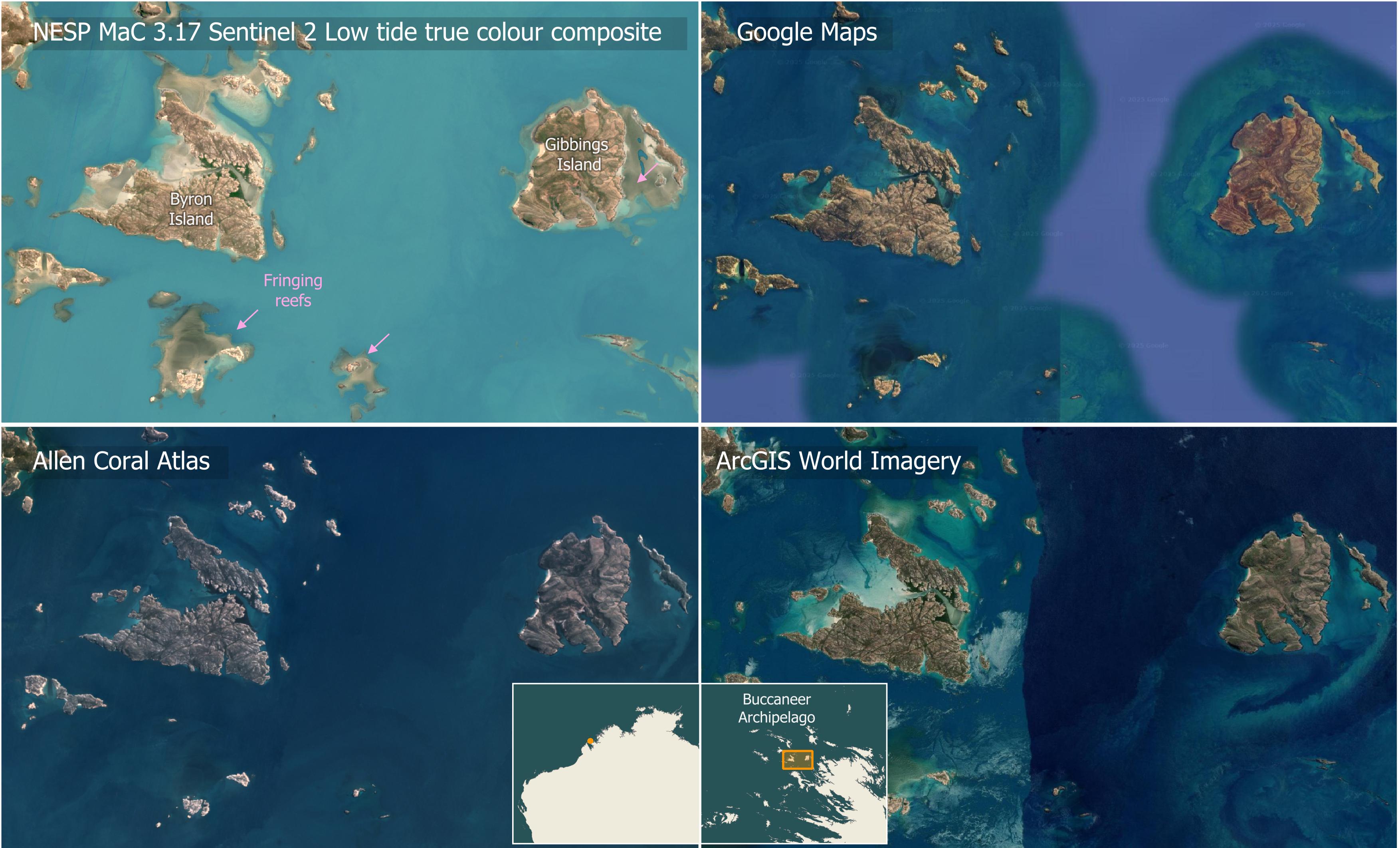
Sentinel 2 Low-tide composite imagery verses other common basemap imagery for a region in the Kimberley (Byron Island, Gibbings Island). This region has large tides that lead to turbid waters and so reefs are largely invisible except at low tide. The Low-tide composite imagery is based on the ten lowest tide Sentinel 2 images and can show features that only appear at low tide. This allows us to see fringing reefs that are largely invisible in Google Maps, the Allen Coral Atlas and ArcGIS World Imagery.