NESP-MaC-3.17-Datastory-reefs-composite.jpg
Image
Licence
Download original image
 Eric Lawrey, Australian Institute of Marine Science. Source imagery: European Union, contains modified Copernicus Sentinel data 2024, processed with EO Browser
Eric Lawrey, Australian Institute of Marine Science. Source imagery: European Union, contains modified Copernicus Sentinel data 2024, processed with EO Browser
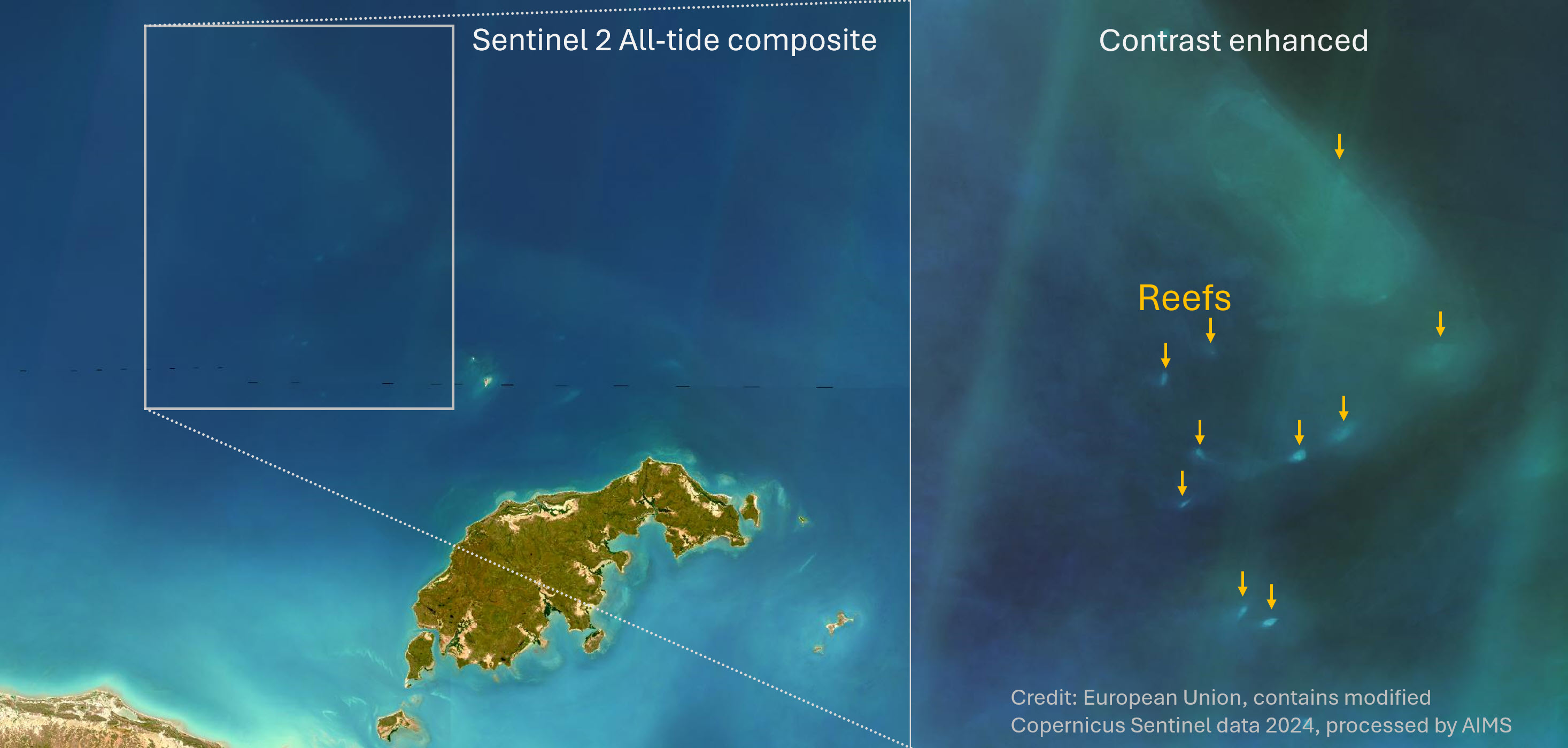
Description
Combining many satellite images, smooths out the turbid plumes, allowing reefs that were invisible in the daily imagery to become visible. The imagery is still hazy and needs contrast enhancement to see these reefs, but it allows previously unmapped reefs to be identified and mapped.