
NESP-MaC-3.17-Datastory-Offshore-Ashmore.jpeg
 Eric Lawrey, Australian Institute of Marine Science. Contains modified Copernicus Sentinel data 2024, processed by AIMS.
Description
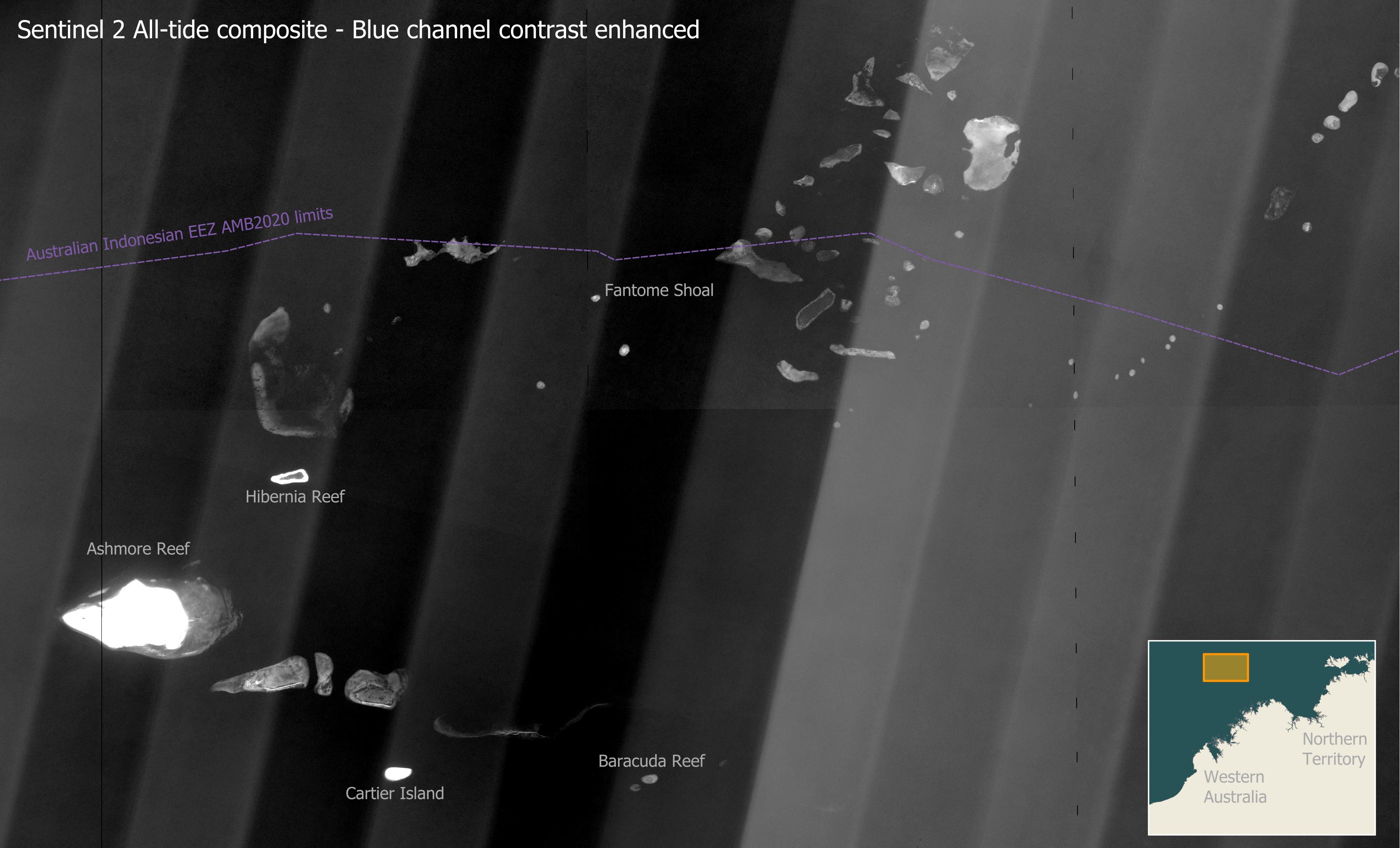
This map shows the many banks and shoals on the edge of the north west Australian continental shelf. Most of these features are 20 – 25 m deep. At this depth the blue channel of the All-tide satellite imagery provides the best view, with contrast enhancement used to brighten these deep features. Shallow reefs, such as Ashmore and Cartier Island, are blown out white due to the contrast enhancement. Due to the extreme brightening we can also see vertical angled light and dark bands across the imagery. This is caused by each of the 12-part segmented sensor in the Sentinel 2 satellite viewing the scene from a slightly different angle. This banding was not corrected for in the imagery, but is only visible with high levels of contrast enhancement.
This coral reef banks straddle the Australian Indonesian Exclusive Economic Zone. This map shows Ashmore Reef, Hibernia Reef, Fantome Shoal, Cartier Island and Baracuda Reef.